
Product Introduction
Addressing the lack of industry application content in UAV professional development, the SESP-U1 system, as a UAV industry application simulation platform for education and training, relies on refined modeling and flight control simulation technology to provide multiple industry application training projects such as basic flight, power, security, surveying and mapping, plant protection, and formation flight, providing users with a complete UAV simulation training solution.
Prodcut Features
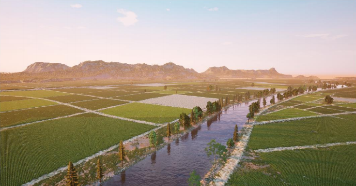
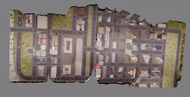
Realistic Scenes
Using a brand-new AAA-level 3D engine for scene reconstruction, it provides cinematic-grade rendering and dynamic physical effects to create realistic application scenarios. It can be used for simulation training in industries such as power line inspection, security search and rescue, geographic surveying, agricultural plant protection, and formation flight. It is compatible with mainstream VR headsets to achieve an immersive training experience.

Real Control
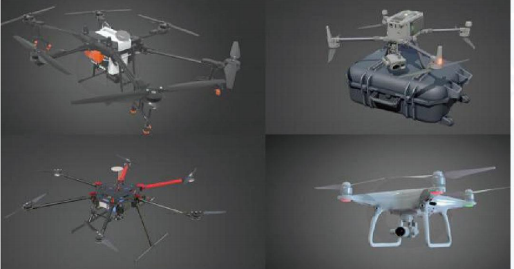
Based on an advanced physics simulation engine, the system recreates the flight characteristics of drones and simulates the impact of environmental factors on them. It integrates a real drone remote controller, providing the same operational experience as a real drone. The system offers a wide variety of drone models to meet the simulation training needs of different industries.

Application Scenarios
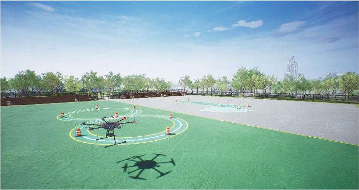
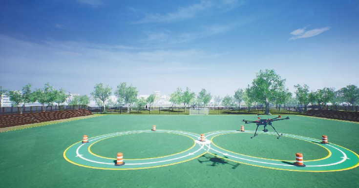
Basic flying
Based on the relevant assessment standards for civilian drone pilots, the system is designed with training and assessment items such as takeoff, landing, multi-faceted hovering, four-way flight, circular flight, and figure-eight flight. It supports functions such as guidance prompts, yaw reminders, horizontal and vertical track display and assessment.
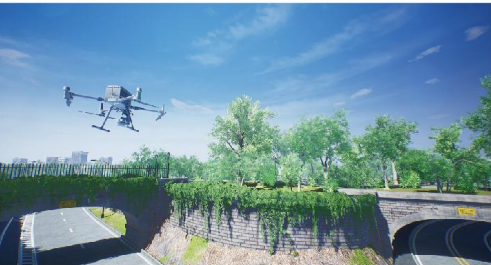
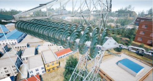
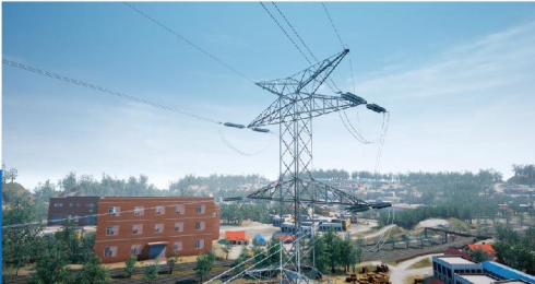
Powerline Inspection
The system covers various voltage levels, power transmission and distribution, and typical environments and tower types for AC and DC overhead lines, providing detailed modeling (pin-level) for line corridor towers and fittings. It strictly follows the drone inspection image capture process and has functions such as training mode, assessment mode, dynamic defect library, special operations, and photo verification.

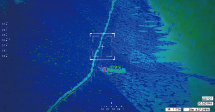
Security Applications
The system provides training tasks such as personnel search and fixed-point throwing. Through multi-scenario and highly flexible task settings, users can master the application skills and operational techniques of mounted equipment such as infrared thermal imagers, searchlights, and throwers.

Surveying and Mapping Applications
The system provides surveying and mapping training tasks such as orthophotos, oblique photography, and laser Lidar scanning. It supports flight route planning and overlap rate parameter settings, and allows virtual data to be post-processed on software such as Context-Capture and Pix4D. It can realize simulation training for the entire process of surveying and mapping applications, both in the field and in the office.
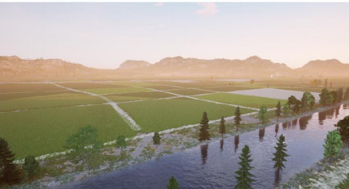
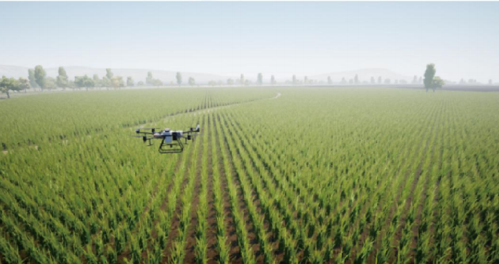
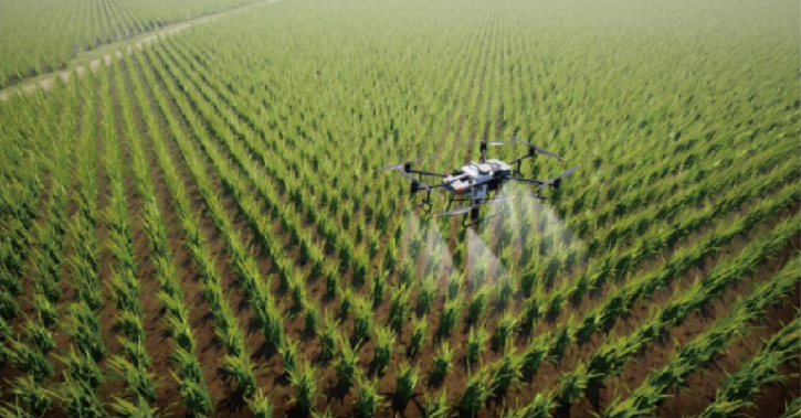
Agricultural Plant Protection
It offers a variety of operations including pesticide spraying, sowing, and fruit tree operations, covering a wide range of common basic crops such as rice, wheat, corn, and fruit trees.
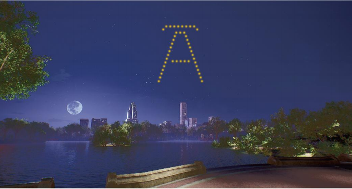
Formation Flying and Aerial Photography
The system offers multi-aircraft formation flight simulation, supporting one-click takeoff and landing, position control, trajectory planning, formation changes, and lighting control. It provides a variety of beautifully designed scenes, including seaside, mountain, and urban landscapes, with dynamic lighting effects that change according to day and night cycles.

Contact for More Information
Focus on quickly responding to your needs and customizing exclusive services from a professional perspective