10 Industrial Drone Applications
The development of industrial drones has been very fast from limited use to necessary productivity tools in different sectors. In the year 2025 the development of autonomous flight, AI vision, payload capacity, and energy systems are the factors that contribute to the drones performing more complex, mission-critical tasks. The applications of industrial drones include infrastructure inspections, and precision agriculture that change the data collection, asset management, and risk mitigation processes of different organizations.
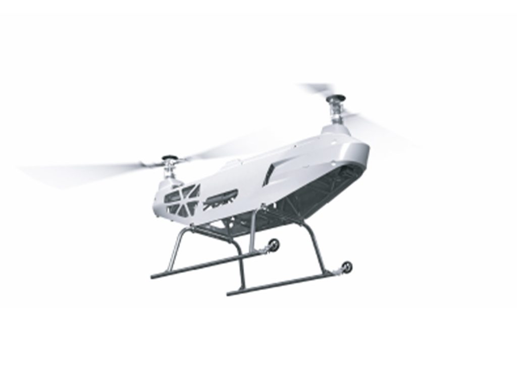
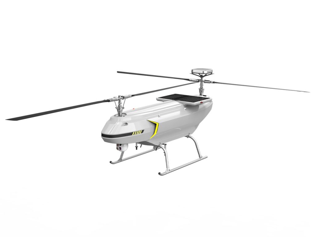
What Is an Industrial Drone
An industrial drone is a considerable drone with no pilot on board, mainly for commercial and industrial uses, not for fun. It is primarily intended for operations like inspection, surveying, monitoring, and data acquisition in places that are either high-risk or difficult to access.
Industrial drones are more than just aerial vehicles like consumer ones; they come as a total operational system that integrates a dependable airborne platform, sensors, software, and data-processing tools. They are made to last and are thus very dependent, stable, and capable of carrying heavy loads and non-stop operation; and consequently, they are the main contributors to the improvement of efficiency, safety, and decision-making in the whole range of the industries that they are used, such as energy, infrastructure, agriculture, construction, and security.
10 Industrial Drone Applications
Technological innovations like the autonomous systems, sensors at their best, connectivity, and data processing on a high level have turned industrial drones into the most indispensable instruments across different industries by 2025. Global market research confirms that the influence and application of drones in the industrial and commercial sectors are still expanding and their use is increasingly widespread in monitoring, agriculture, energy, disaster response, and logistics around the globe.
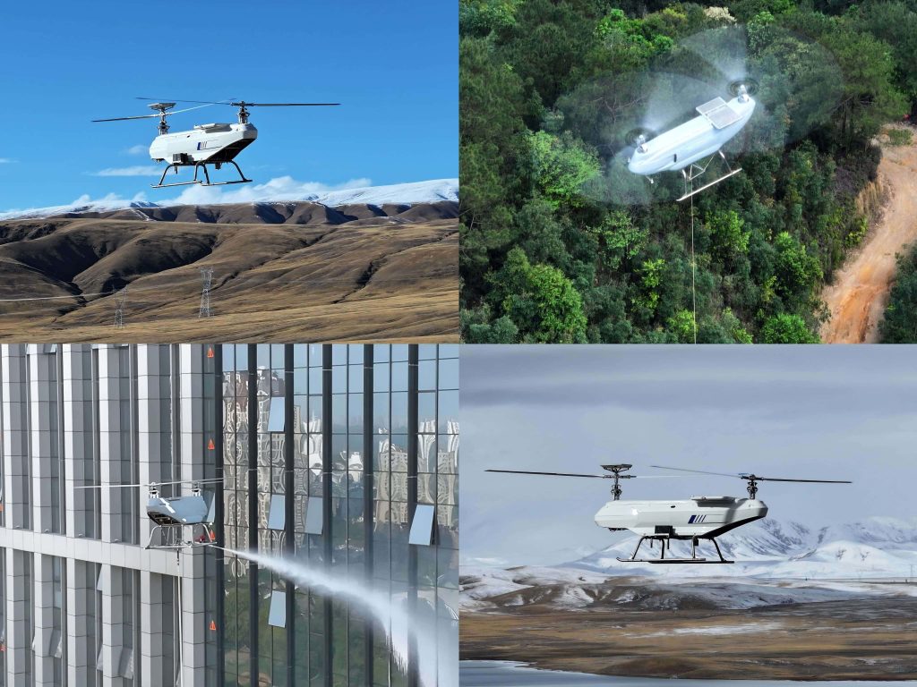
Infrastructure Inspection and Maintenance
Infrastructure assets which include bridges, highways, railroad tracks, pipe systems, electric lines, and manufacturing plants always have to go through routine and precise inspections in order to be safe, reliable, and conform to the law. UAVs come in as an answer to this requirement by their aerial mobility being combined with the state-of-the-art sensing, data processing, and automation technologies.
You can see below the table that depicts the major functions of the industrial drones in the infrastructure inspection by actually outlining the usual inspection processes, the drone implementations, the sensor types, and the main advantages that they bring about in the operation.
| Application / Function | Description | Recommended Drone Type | Typical Sensor / Equipment | Key Value / Benefits |
| Close-Range Visual & Thermal Inspection | Bridges, steel constructions, concrete areas and powerline insulators can be pictured in detail. | Multirotor Drones | High-resolution RGB cameras, Thermal cameras | Cracks, corrosion and overheating are detected; inspection safety is improved |
| 3D Mapping & LiDAR Scanning | Condition evaluation, deformation analysis, and change detection are just a few of the applications that high-precision 3D models and digital twins can produce. | Fixed-Wing Drones, VTOL Drones | LiDAR scanners, Photogrammetry cameras | Monitoring is done with great precision; predictive maintenance is backed up; quality of data is high |
| Automated & Scheduled Missions | Monitoring of pipelines, highways or remote areas can be done automatically using the human-free scenario. | Tethered Drones, Drone-in-a-Box Systems | Autonomous flight systems, Docking/autonomous platforms | The amount of manual labor is decreased; the possibility of continuous monitoring is enabled; the efficiency of coverage is increased |
| Real-Time Data Transmission & AI Analytics | Inspection data can be sent immediately and AI can be used for malfunction detection. | Multirotor Drones, VTOL Drones | Edge computing, Cloud platforms, AI analytics software | Decision making is faster; maintenance workflow is optimized; operational efficiency is improved |
| Bridge Inspections | Continuous photographic and LiDAR data capture for structural elements (beams, decks, piers, cables). | Multirotor Drones | High-resolution RGB cameras, LiDAR scanners | Planning of maintenance without lane closures or lifts is done by monitoring the structural integrity |
| Powerline & Transmission Inspection | Long corridors can be inspected, and problems with insulators, conductors, and hardware can be discovered. | Multirotor Drones, VTOL Drones | High-resolution cameras, Thermal cameras, AI analytics | Identify faults Faults are quickly identified; reporting is done in real-time; human risk is reduced |
| Pipelines & Linear Assets Survey | Pipelines can be surveyed for leaks, corrosion, and right-of-way encroachments. | Fixed-Wing Drones, VTOL Drones | LiDAR scanners, High-res cameras, Mapping software | Monitoring of assets is accurate; geospatial records are fed into condition systems; safety is improved |
Energy Sector Monitoring
The energy sector has a great reliance on industrial drones for monitoring, inspection, and maintenance of the essential infrastructures like power lines, substation units, solar and wind power generations, and so on. Drones facilitate the operations to be more efficient, pose fewer risks to workers, and deliver data of very good quality, thus aiding predictive maintenance and grid reliability.
The following table outlines the different applications and workflows of industrial drones in the energy sector, along with the types of drones, sensors, and operational benefits:
| Application / Function | Description | Recommended Drone Type | Typical Sensor / Equipment | Key Value / Benefits |
| Power Line & Transmission Inspection | Regular monitoring of high-voltage power lines to find out if there are corrosion, overheating, and mechanical failure | Fixed-Wing Drones, VTOL Drones | High-resolution RGB cameras, Thermal cameras | Effective inspection of long-range assets; early detection of faults; enhanced safety |
| Substation & Industrial Facility Monitoring | Check transformers, circuit breakers, and power lines for overheating or anomalies | Thermal cameras, RGB cameras | Less human contact with danger zones; thorough status evaluation | |
| Solar Farm Inspection | Identify defective, dirty, or shaded solar panels in order to increase energy output | Multirotor Drones | RGB cameras, Multispectral cameras | Higher energy efficiency; ability to do preventive maintenance; fast area coverage |
| Wind Turbine Blade Inspection | Monitor turbine blades for cracks, erosion, or lightning strikes | Multirotor Drones, VTOL Drones | RGB cameras, High-zoom cameras, Thermal cameras | Less downtime; better maintenance scheduling; economical rope-access works |
| Continuous / Scheduled Monitoring | Energy facilities or critical assets that are monitored over the long term | Tethered Drones, Drone-in-a-Box Systems | RGB cameras, Thermal cameras, Autonomous flight systems | Allowing robots to do inspections; keeping a watch in a standard way; less requiring labor |
Precision Agriculture
Drones are being used more and more in precision agriculture to monitor and optimize crop growth. Drones along with multispectral imaging and fitted with variable-rate application systems give the early warning of crop stress, nutrient shortage and pest infestation which results in less manual labor, more accurate yield prediction and the farm’s overall efficiency.
| Application / Function | Description | Recommended Drone Type | Typical Sensor / Equipment | Key Value / Benefits |
| Crop Health Monitoring | Detect plant stress, disease, and nutrient deficiency across large fields | Multirotor Drones, Fixed-Wing Drones | Multispectral cameras, RGB cameras | Improve yield prediction; enable early intervention |
| Variable-Rate Spraying | Apply fertilizers and pesticides precisely based on crop condition | Multirotor Drones | Spraying systems, RTK positioning | Reduce chemical use; improve application efficiency |
| Soil & Field Analysis | Analyze soil condition and field variability | Fixed-Wing Drones | Multispectral sensors, Mapping software | Support data-driven planting and irrigation planning |
Construction Site Surveillance & Progress Mapping
Starting in 2025, industrial drones have already established themselves as necessary digital tools in construction management, offering real-time site visibility via high-quality aerial imaging, flight planning automated, and BIM integration. The uninterrupted aerial data gathering covering the project lifecycle is one of the ways that accurate progress tracking is facilitated, delays are reduced, cooperation is improved, and more data-driven decision-making is authorized.
| Application Area | Drone Use Case | Recommended Drone Type | Key Sensors / Systems | Primary Benefits |
| Site Surveillance | Monitor safety and site activity | Multirotor | RGB cameras, live video | Improved safety oversight |
| Progress Mapping | Track construction progress | Multirotor, Fixed-Wing | Photogrammetry systems | Accurate timeline tracking |
| BIM Comparison | Validate as-built vs design | Multirotor, VTOL | 3D modeling software | Reduced rework |
| Earthworks Measurement | Measure cut-and-fill volumes | Fixed-Wing, VTOL | LiDAR, RTK GNSS | Cost control; precision |
| Automated Site Reporting | Scheduled data collection | Drone-in-a-Box Systems | Autonomous flight software | Consistent documentation |
Environmental and Disaster Monitoring
By then, industrial drones had transformed into essential assets for monitoring the environment and controlling disasters, providing quick high-resolution images of dangerous or unreachable places. The improvements in endurance, sensor integration, real-time data transmission and geospatial intelligence made it possible to do early warning, impact assessment, and long-term environmental analysis thereby the public sector’s preparedness, response and recovery planning were strengthened.
| Application Area | Drone Use Case | Recommended Drone Type | Key Sensors / Payloads | Primary Benefits |
| Wildfire Watch | Hotspots detection and fire spread tracking | Multirotor, Fixed-Wing | Thermal cameras, RGB imaging | Early detection; firefighter safety |
| Flood Analysis & Landslides | Flood extent and terrain changes assessment | Fixed-Wing, VTOL | LiDAR, RGB cameras | Faster evacuation planning; risk reduction |
| Environmental Survey | Vegetation, water, and pollution monitoring | Multirotor, Fixed-Wing | Multispectral sensors | Ecological protection; compliance |
| Post-Disaster Review | Infrastructure damage evaluation | Multirotor, VTOL | High-resolution cameras, LiDAR | Accelerated recovery planning |
| Long-term monitoring for changes | Environmental trends tracking over time | Fixed-Wing, Long-Endurance UAVs | Multispectral, GNSS | Data-driven environmental management |
Warehouse and Industrial Logistics Operations
Over the next few years, that is, up until 2025, drones will be a major part of the industrial sector. They will be mainly in warehouses and will totally replace human workers, thus making inventory operations really fast and accurate. Drones that rely on indoor navigation technologies along with AI vision systems and private or edge computing will use visual positioning, LiDAR, and SLAM to be able to fly indoors and outdoors without GPS and still be safe and very accurate even in big and complicated indoor areas.
| Application Area | Drone Use Case | Recommended Drone Type | Key Sensors / Systems | Primary Benefits |
| Inventory Scanning | – Scanning barcodes, QR codes, and RFID tags. | Indoor Multirotor Drones | RGB cameras, RFID readers | Rapid stock checking; reduced manpower |
| Cycle Counting | – Conducting periodic inventory audits. | Autonomous Indoor Drones | Vision systems, WMS integration | Increased data integrity; diminished inconsistencies |
| Warehouse Mapping | – Creating virtual indoor maps in 3D. | Multirotor Drones | LiDAR, SLAM technology | Layout enhancement; yield addition |
| Material Tracking | – Keeping track of stock movement. | Indoor-Outdoor Hybrid Drones | Real-time connectivity | Augmented traceability; integrated systems |
| Safety Monitoring | – Checking areas of high or restricted access. | Compact Multirotor Drones | Cameras, depth sensors | Better workplace safety. |
Mining and Earthworks Surveying
The year 2025 marks the time when industrial drones become indispensable in mining and major earth-moving operations. They will use the synergy of photogrammetry, LiDAR, and automated flight planning to measure complex or dangerous zones quickly, correctly, and uniformly. The use of UAVs for surveying contributes to the safety of the operation, the consistency of the data, and the efficiency of the whole process while giving live topographic and volumetric data for the purposes of mine planning, production monitoring, and compliance reporting during the entire project life cycle.
| Application Area | Drone Use Case | Recommended Drone Type | Typical Sensors / Payloads | Key Benefits |
| Topographic assessment | Create models of terrain and orthomosaics, | Fixed-Wing, VTOL Fixed-Wing | RGB cameras, LiDAR | Accurate site planning; large-area coverage |
| Geometry measurement | Compute volumes of stockpiling and excavation, | Multirotor, Fixed-Wing | RGB cameras, RTK GNSS | Precise production monitoring; cost management |
| Shear slope measurement | Identify ground movements and landslides risks, | Multirotor, VTOL | LiDAR, high-resolution imaging | Safety enhancement; risk detection at an early stage |
| Quantity survey | Keep track of earthworks as time goes on, | Fixed-Wing, Multirotor | Photogrammetry systems | Schedule management; less rework |
| Compliance design | Oversee the processes of rehabilitation and management of waste. | Multirotor, Fixed-Wing | Multispectral sensors | Adherence to regulations; preservation of the environment |
Security and Surveillance
Drones have been listed among the major security and surveillance tools by the year 2025 and used AI-driven video analytics, unmanned aerial patrols, and instantaneous communication to spot dangers quickly and assist in fast reactions.Offering unrivaled versatility, height, and quick setup as compared to stationary cam and ground patrols, UAVs are especially efficient in active or risky areas.
| Security Scenario | Drone Application | Recommended Drone Type | Key Sensors / Systems | Primary Benefits |
| Perimeter Patrol | Automated patrol of facility boundaries | Multirotor, VTOL Fixed-Wing | RGB cameras, AI analytics | Early intrusion detection; flexible coverage |
| Intrusion Detection | Identify and track unauthorized access | Multirotor, Tethered Drones | Thermal sensors, AI vision | 24/7 monitoring; faster alerts |
| Large-Area Surveillance | Monitor ports, borders, industrial zones | VTOL Fixed-Wing | Long-range optics, encrypted links | Extended endurance; wide-area visibility |
| Event & Crowd Monitoring | Oversee crowd movement and safety | Multirotor | Zoom cameras, real-time video | Improved crowd control; incident prevention |
| Incident Response & Evidence | Record and assess security breaches | Multirotor | High-resolution imaging | Reliable documentation; compliance support |
Emergency Response and Public Safety
It is expected that by 2025 the deployment of industrial drones for emergency response and public safety will be more widespread, as they would be configured with real-time data transmission, AI analytics, thermal imaging technology, and autonomous flight to assist first responders before, during, and even after emergencies. The quick access of drones to dangerous or hard-to-reach areas allows powerful and timely decision-making, as well as quicker response times and safe conditions for the responders.
| Application Area | How Drones Are Used | Recommended Drone Type | Typical Sensors / Payloads | Key Benefits |
| Rapid Incident Assessment | Aerial overview of disaster zones and access routes | Multirotor, VTOL Fixed-Wing | RGB cameras, live video links | Faster situational awareness; improved coordination |
| Search and Rescue (SAR) | Locate missing or trapped individuals | Multirotor, VTOL | Thermal cameras, AI detection | Higher rescue success rate; night operation |
| Firefighting Support | Monitor fire spread and hotspots | Multirotor, Fixed-Wing | Thermal sensors, zoom cameras | Reduced firefighter risk; better fire control |
| Crowd & Public Safety | Monitor evacuations and public areas | Multirotor, Tethered Drones | RGB cameras, loudspeakers | Improved crowd control; real-time alerts |
| Post-Disaster Damage Assessment | Capture imagery and 3D models | Multirotor, VTOL | High-resolution cameras, LiDAR | Faster recovery planning; accurate reporting |
Delivery and Transport Trials
In 2025, drones for cargo and delivery were no longer just experimental ideas but were already practical logistics solutions. The improvements in autonomy, airspace management, propulsion, and regulations have facilitated their widespread adoption across the globe, making it possible to use them for last-mile delivery, mid-range distribution, and even long-distance cargo transport that were previously done by manned aircraft or trucks.
| Application / Function | Description | Recommended Drone Type | Typical Sensor / Equipment | Key Value / Benefits |
| Last-Mile Delivery | Transport parcels, food, medical supplies to end customers | Multirotor Delivery Drones, VTOL Cargo Drones | Autonomous navigation, precision release systems | Faster delivery; reduced labor; decentralized logistics |
| Middle-Mile Logistics | Shuttle cargo between distribution hubs over moderate distances | Fixed-Wing Cargo Drones | Long-range navigation systems, BVLOS capability | Lower cost than manned flights; efficient hub connectivity |
| Heavy-Lift Freight Transport | Long-distance transport of industrial or bulk goods | Heavy-Lift Unmanned Aircraft | Redundant flight control, long-endurance propulsion | Expand logistics capacity; industrial supply support |
| Remote & Specialized Cargo Missions | Deliver goods to remote or difficult terrain work sites | Hybrid VTOL Cargo Drones | Winch systems, advanced collision avoidance | Access challenging locations; reduce ground transport delays |
Conclusion
After a few years of quick technological advancements, industrial drones have already become essential tools in several sectors like infrastructure, energy, agriculture, construction, and public safety; they are no longer considered experimental technology. Their worth comprises not only the ability to fly but also the provision of actionable data and the automation features attached to it.
Consequently, industrial drones will keep on moving to new application fields through better hardware performance and software intelligence; thus, they will change the way of operating in complex, high-risk, and data-intensive environments for various sectors.
Related Products