“UAV + Manual” Collaboration to Implement Nighttime Ecological Environment Supervision
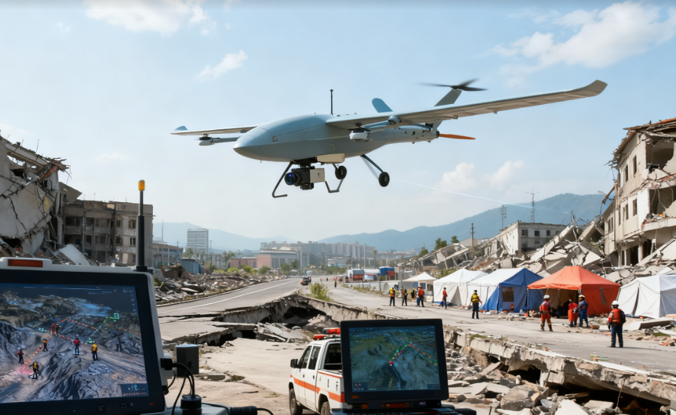
After a 6.2-magnitude earthquake struck a province in 2024, rescue teams immediately deployed vertical take-off and landing fixed-wing drones. Equipped with LiDAR and high-definition cameras, the drones took off 15 minutes after the quake, completing 3D terrain modeling of a 30-square-kilometer disaster area, identifying 12 collapsed buildings and 5 blocked road sections. Thermal imaging detected heat signals from 3 trapped individuals, with coordinates transmitted in real-time to the ground command center, guiding rescue teams for precise location and successfully rescuing 7 survivors. The drones continued to patrol for 72 hours, transmitting a total of 800GB of data, providing critical support for secondary disaster warnings and the allocation of rescue resources, improving search and rescue efficiency by 40%.