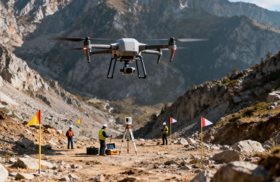
How Drones Improved Topographic Surveying in Difficult Terrain
Project Overview
A mountain highway route selection project faced significant challenges with traditional topographic surveying.
The project area included steep slopes, canyons, and other difficult terrain, making some locations difficult or unsafe for conventional ground surveying.
Under the traditional surveying approach, a team of approximately 20 workers required around 3 months to collect terrain data across only 50 square kilometers.
The complex terrain also created potential surveying blind spots, particularly in steep slopes, deep valleys, and canyon areas.
To improve surveying efficiency and data coverage, the project team introduced a multirotor UAV surveying system in 2024.
Equipped with LiDAR and oblique photography equipment, the UAV system established a new aerial surveying workflow, allowing topographic data to be collected from the air across difficult-to-access terrain.
The solution provided the project team with a more flexible and efficient approach to collecting terrain information for highway route selection.
The Challenge
Complex Mountainous Terrain
The highway route selection area is located in mountainous terrain with significant elevation changes and complex geographic features. Steep slopes, canyons, and valleys created challenges for conventional field surveying.
Difficult-to-Access Areas
Some terrain features are difficult or unsafe for survey teams to access directly. This limits the ability of ground teams to collect comprehensive data from every required location.
Limited Survey Coverage
Traditional surveying required approximately 3 months for a team of 20 workers to collect data across only 50 square kilometers. Large-area surveying therefore required significant time and manpower.
Potential Surveying Blind Spots
Steep slopes and canyon areas can create gaps in conventional ground-based measurements. Missing or incomplete terrain information can affect subsequent highway route analysis and engineering planning.
High Field Workload
Survey teams must repeatedly travel through mountainous terrain to collect measurements. This increases both labor requirements and the operational difficulty of the surveying process.
The UAV Surveying Solution
To address these challenges, the project team introduced a multirotor UAV surveying system in 2024.
The UAV was equipped with:
- LiDAR
- Oblique photography equipment
- Aerial surveying capabilities
The system introduced an “aerial surveying” workflow that moved a significant portion of terrain data collection from the ground into the air.
The new workflow follows:
UAV Flight Planning
↓
Aerial Data Acquisition
↓
LiDAR 3D Scanning
↓
Oblique Photography
↓
Digital Terrain Modeling
↓
Highway Route Analysis
This approach provides engineers with a more comprehensive view of mountainous terrain while reducing dependence on difficult ground access.
How the UAV Surveying Works
1. Plan the Flight Mission
The survey area is divided into designated zones based on the highway route selection requirements. Flight paths are planned to provide systematic coverage of the target terrain.
2. Conduct Multirotor UAV Flights
The multirotor UAV is deployed to collect aerial data across the mountainous survey area.
Its ability to operate flexibly at relatively low altitudes makes it suitable for detailed surveying in complex terrain.
3. Capture LiDAR Data
The LiDAR system collects three-dimensional information about the terrain. This helps generate detailed elevation and topographic information for steep slopes, valleys, and other complex areas.
4. Capture Oblique Images
Oblique photography provides imagery from multiple angles, adding visual information that complements LiDAR data. This can help engineers better understand terrain features and surrounding conditions.
5. Generate Digital Terrain Data
The collected LiDAR and image data are processed to generate digital representations of the surveyed terrain. These datasets provide a more detailed basis for engineering analysis.
6. Support Highway Route Selection
Engineers can use the digital terrain information to compare potential highway alignments and evaluate terrain-related construction conditions.
Key Technologies
Multirotor UAV
Multirotor UAVs provide flexible flight capabilities and can operate effectively in mountainous environments where access for conventional surveying teams may be limited.
LiDAR 3D Mapping
LiDAR rapidly captures three-dimensional terrain information, making it particularly useful for mapping steep slopes, valleys, and other complex terrain.
Oblique Photography
Oblique imagery provides multi-angle visual information that complements LiDAR data and helps improve terrain interpretation.
Digital Terrain Modeling
The collected aerial data can be processed into digital terrain models that provide engineers with a more comprehensive representation of the survey area.
Aerial Surveying
Moving data acquisition into the air allows difficult terrain to be surveyed without requiring personnel to physically reach every location.
Project Results
50 km² Survey Area
The project used UAV surveying to collect terrain information across the highway route selection area, replacing a large portion of the traditional ground-based surveying workflow.
Reduced Dependence on Ground Access
Aerial surveying reduced the need for survey personnel to physically enter steep slopes, canyons, and other difficult terrain.
Improved Terrain Data Coverage
LiDAR and oblique photography provided complementary three-dimensional and visual information, helping address potential data gaps in complex terrain.
More Efficient Route Selection Support
Digital terrain information provided engineers with a broader basis for evaluating highway alignment options and understanding terrain conditions.
Reduced Field Surveying Workload
By transferring terrain data acquisition to UAVs, the project reduced dependence on large field teams for every surveying location.