How Drone and Ground Teams Improved Environmental Supervision in Hard-to-Reach Areas
Project Overview
Environmental authorities often need to monitor large and complex areas, including riverbanks, industrial park boundaries, ravines, and dense forests.
Traditional manual inspections can be limited by terrain and accessibility, making certain areas difficult to reach and creating potential monitoring blind spots.
To improve nighttime environmental supervision, the enforcement team introduced a drone-and-ground collaboration model.
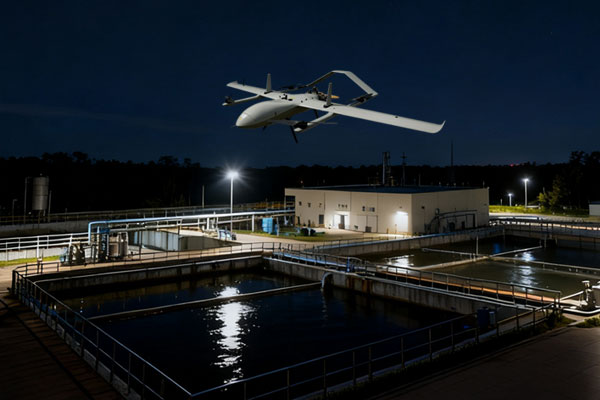
Drones equipped with high-definition cameras and infrared monitoring modules conduct aerial patrols across hard-to-reach areas and perform close-range inspections of key locations.
These include the 500-meter core area surrounding national monitoring stations and industrial wastewater discharge outlets.
The aerial monitoring system helps identify potential environmental violations such as illegal discharge, leakage, and unauthorized facility shutdowns.
At the same time, law enforcement personnel record monitoring data and conduct preliminary analysis, creating a closed-loop workflow:
Aerial Monitoring → Data Collection → Ground Verification
This approach enables environmental authorities to combine aerial monitoring with on-site enforcement for more efficient and comprehensive nighttime supervision.
The Challenge
Difficult-to-Reach Areas
Environmental monitoring often involves areas that are difficult for inspectors to access, including:
- Riverbanks
- Industrial park boundaries
- Ravines
- Dense forests
- Other remote areas
These locations can be challenging to inspect thoroughly using conventional ground patrols.
Nighttime Monitoring Difficulties
Some environmental activities may occur at night, when conventional visual inspection becomes more difficult. Limited visibility can increase the challenge of identifying potential illegal activities.
Monitoring Blind Spots
Ground-based inspection cannot always reach every area. Ravines, dense vegetation, and other inaccessible terrain can create areas that are difficult to monitor effectively.
Large Monitoring Areas
Environmental authorities may need to patrol several square kilometers during a single inspection operation. Manually covering large areas can require significant personnel and time.
Need for Rapid Ground Verification
Identifying a potential environmental violation is only the first step. Law enforcement personnel also need to quickly verify the situation on the ground and collect relevant information for further action.
The Drone + Ground Collaboration Solution
To overcome these challenges, the enforcement team adopted a drone-and-ground collaborative inspection model.
The solution combines:
- High-definition aerial imaging
- Infrared monitoring
- Nighttime aerial patrols
- Close-range inspection
- Ground-based data recording
- Preliminary data analysis
- On-site verification
The complete workflow is:
Drone Patrol
↓
Potential Violation Detection
↓
Data Collection
↓
Ground Verification
↓
Environmental Enforcement
This allows drones to perform broad-area monitoring while ground personnel focus on locations requiring detailed investigation.
How the Nighttime Inspection Works
1. Plan the Monitoring Area
Inspection routes are established according to environmental monitoring requirements.
Priority areas include riverbanks, industrial park boundaries, national monitoring stations, and industrial wastewater discharge outlets.
2. Conduct Aerial Patrols
Drones equipped with high-definition cameras and infrared monitoring modules patrol the designated areas. A single drone can cover approximately 5 square kilometers per hour.
3. Monitor Hard-to-Reach Areas
The drones can inspect locations that may be difficult or unsafe for personnel to access, including ravines, dense forests, and remote riverbank areas.
4. Inspect Key Locations
The system conducts closer inspections of priority areas, including the 500-meter core area surrounding national monitoring stations and industrial sewage outlets.
5. Identify Potential Environmental Violations
Aerial monitoring can help identify potential activities such as:
- Illegal discharge
- Leakage
- Unauthorized facility shutdowns
- Other suspicious environmental activities
6. Collect and Analyze Data
Law enforcement personnel record the relevant monitoring information and conduct preliminary analysis. This provides an initial basis for determining whether further investigation is required.
7. Conduct Ground Verification
When a potential violation is identified, personnel can conduct targeted on-site verification. This creates a direct connection between aerial detection and ground-based enforcement.
Key Technologies
High-Definition Cameras
High-definition cameras capture detailed visual information during aerial patrols, supporting the identification and documentation of potential environmental abnormalities.
Infrared Monitoring
Infrared monitoring provides additional detection capabilities in low-light and nighttime conditions. This allows drones to continue environmental monitoring beyond normal daylight hours.
Aerial Monitoring
Drone patrols provide broader coverage than conventional point-based ground inspections and allow monitoring teams to reach difficult terrain more efficiently.
Ground Verification
Ground teams conduct close-range inspection and verification after potential problems are identified through aerial monitoring.
Air-Ground Data Collaboration
Aerial monitoring data and ground inspection information are combined into a closed-loop environmental enforcement workflow.
Project Results
5 km² of Patrol Coverage per Hour
A single drone can patrol approximately 5 square kilometers per hour, enabling large areas to be monitored within a relatively short period.
More Than 3× Higher Inspection Efficiency
Compared with manual inspections, the drone-based approach achieves more than three times the inspection efficiency.
Reduced Terrain Limitations
Drones can monitor ravines, dense forests, riverbanks, and other areas that may be difficult or inaccessible for ground inspection teams.
Fewer Monitoring Blind Spots
Aerial monitoring provides an additional perspective that complements conventional ground patrols and helps address areas that may otherwise remain difficult to observe.
Improved Nighttime Monitoring
The combination of high-definition cameras and infrared monitoring allows environmental authorities to conduct more effective inspections during nighttime operations.
Closed-Loop Enforcement
The integration of aerial monitoring, data collection, and ground verification creates a complete workflow from detection to verification.