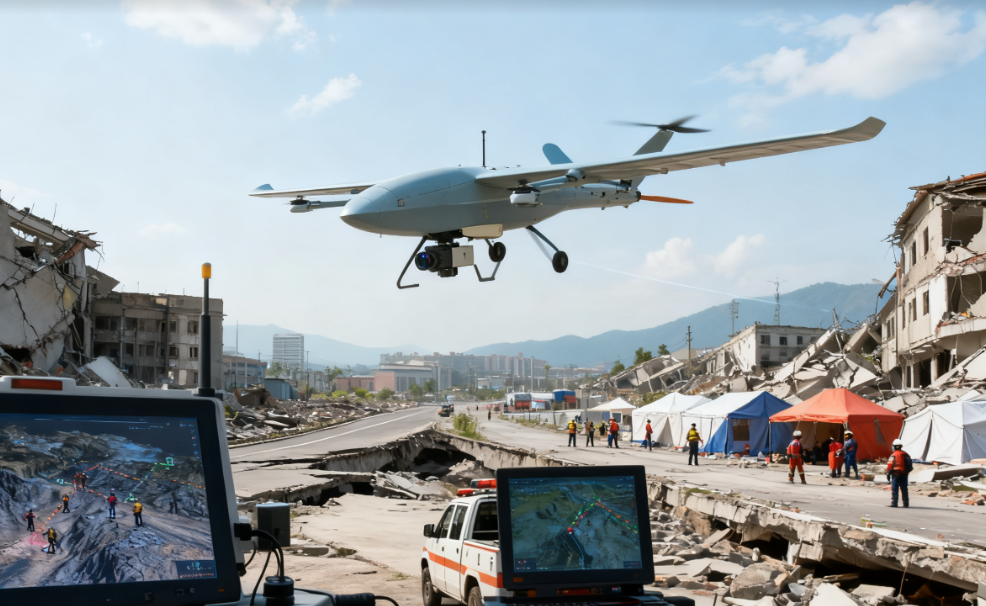
Drones Support the Golden 72 Hours of Earthquake Rescue
Project Overview
After a 6.2-magnitude earthquake struck a province in 2024, rescue teams immediately initiated emergency response operations.
The earthquake caused widespread disruption across the affected area, including collapsed buildings and blocked roads, making conventional ground-based assessment and rescue more difficult.
To obtain rapid aerial intelligence and support search and rescue operations, the emergency response team deployed vertical take-off and landing (VTOL) fixed-wing drones.
Equipped with LiDAR, high-definition cameras, and thermal imaging systems, the drones took off approximately 15 minutes after the earthquake and began surveying the affected area.
The drones completed 3D terrain modeling of approximately 30 square kilometers, identified 12 collapsed buildings and 5 blocked road sections, and used thermal imaging to detect heat signals associated with three trapped individuals.
The locations were transmitted in real time to the ground command center, helping rescue teams conduct more targeted searches and contributing to the successful rescue of seven survivors.
The drones continued aerial patrols for approximately 72 hours, transmitting around 800 GB of data to support secondary disaster warnings, rescue resource allocation, and ongoing situational awareness.
The integrated drone and ground rescue operation improved search and rescue efficiency by approximately 40%.
The Challenge
The Critical Golden 72 Hours
The first hours following a major earthquake are critical for locating and rescuing people who may be trapped under collapsed structures. Rescue teams need accurate information quickly to determine where to allocate personnel and equipment.
Damaged Ground Infrastructure
The earthquake caused multiple roads to become blocked, limiting ground access to affected areas. This made it difficult for rescue teams to quickly obtain a complete overview of the disaster zone.
Large-Area Disaster Assessment
The affected area covered approximately 30 square kilometers. Conducting a comprehensive ground survey across such a large area would require significant time and manpower.
Collapsed Buildings
Collapsed structures created multiple potential rescue locations. Identifying damaged buildings quickly was essential for prioritizing search and rescue operations.
Locating Trapped Survivors
People trapped beneath collapsed structures can be difficult to locate through conventional visual inspection alone. Aerial thermal sensing provided an additional method for identifying potential survivor locations.
Ongoing Secondary Disaster Risks
Even after the initial earthquake, damaged structures, blocked roads, and changing terrain conditions could create additional risks. Continuous aerial monitoring was therefore required beyond the initial search and rescue phase.
The Drone Emergency Response Solution
The rescue team deployed VTOL fixed-wing drones to provide rapid aerial intelligence and continuous monitoring throughout the emergency response.
The drones integrated multiple sensing and communication capabilities:
- LiDAR
- High-definition cameras
- Thermal imaging
- 3D terrain modeling
- Real-time data transmission
How the Drone Rescue Operation Worked
1. Rapid Drone Deployment
The drones took off approximately 15 minutes after the earthquake, allowing aerial assessment to begin during the critical early response period.
2. 3D Terrain Mapping
LiDAR and high-definition cameras were used to survey approximately 30 square kilometers of the affected area. The collected data was used to generate 3D terrain models and provide rescue teams with an updated view of the disaster environment.
3. Identify Structural and Road Damage
The aerial survey identified:
- 12 collapsed buildings
- 5 blocked road sections
This information helped the command center understand the extent of infrastructure damage and identify areas requiring immediate attention.
4. Conduct Thermal Search
Thermal imaging was used to scan disaster areas for heat signals that could indicate trapped people. The system detected heat signals associated with three trapped individuals.
5. Transmit Coordinates in Real Time
The detected locations were transmitted to the ground command center in real time. Rescue teams could then use the information to guide more targeted search and rescue operations.
6. Continue Aerial Monitoring
Following the initial rescue response, the drones continued to patrol the affected area for approximately 72 hours.
The continuous aerial operation provided updated information for:
- Secondary disaster warnings
- Rescue resource allocation
- Disaster-area monitoring
- Ongoing emergency decision-making
Project Results
Drone Deployment in 15 Minutes
The drones were deployed approximately 15 minutes after the earthquake, enabling rapid aerial assessment during the critical early response period.
30 km² of Disaster Area Mapped
The drones completed 3D terrain modeling across approximately 30 square kilometers, providing a comprehensive aerial overview of the affected area.
12 Collapsed Buildings Identified
The aerial survey identified 12 collapsed buildings, helping rescue teams prioritize potential search locations.
5 Blocked Roads Detected
The drones identified five blocked road sections, providing important information for ground rescue route planning.
7 Survivors Successfully Rescued
The integrated aerial and ground rescue operation contributed to the successful rescue of seven survivors.
72 Hours of Continuous Monitoring
The drone fleet continued to patrol the affected area for approximately 72 hours, extending aerial support beyond the initial emergency response.
800 GB of Data Transmitted
Approximately 800 GB of data was transmitted during the operation, providing valuable information for disaster assessment, secondary disaster warnings, and rescue resource allocation.
40% Higher Search & Rescue Efficiency
The integration of drone-based aerial intelligence with ground rescue operations improved overall search and rescue efficiency by approximately 40%.