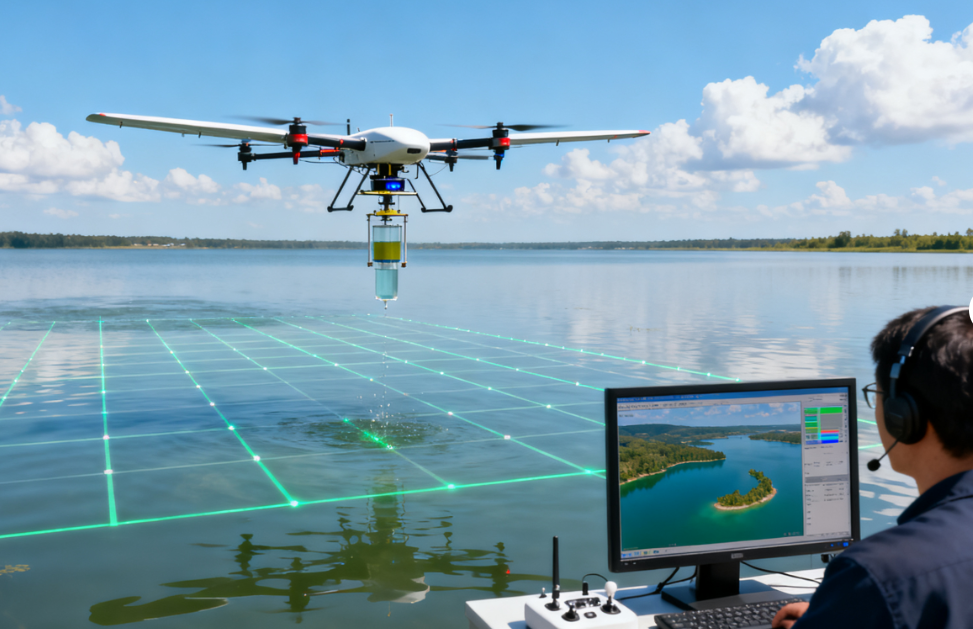
Fixed-Wing Drones Assist in Three-Dimensional Monitoring of Lake Water Quality
Project Overview
The lake is located in a key water source area and covers approximately 50 square kilometers, making regular water quality monitoring essential for environmental protection and water resource management.
Traditional monitoring relies on personnel traveling by boat to collect water samples from multiple locations. A single monitoring session can take approximately 2 days, while the resulting data coverage is less than 30% of the monitored area.
This approach makes it difficult to conduct frequent large-area monitoring and can also make it challenging to identify sudden water quality anomalies in a timely manner.
To improve monitoring coverage and efficiency, a fixed-wing drone water quality monitoring system was introduced.
Equipped with multispectral water quality sensors and automatic sampling devices, the drones follow preset routes to conduct large-area aerial monitoring and sampling.
The system can scan up to 100 square kilometers of water per hour while simultaneously collecting data on six key water quality indicators, including chlorophyll-a, turbidity, and dissolved oxygen.
This creates a more efficient and data-rich approach to monitoring large water bodies.
The Challenge
Large Monitoring Area
The lake covers approximately 50 square kilometers, requiring monitoring across a large and geographically distributed water area. Regularly collecting representative data from multiple locations can be difficult using conventional methods.
Time-Consuming Manual Sampling
Traditional monitoring requires personnel to travel by boat to different sampling points. A single monitoring session can take approximately 2 days, increasing labor and operational requirements.
Limited Monitoring Coverage
Manual sampling provides data from selected sampling points, with overall data coverage of less than 30%. This can make it difficult to obtain a comprehensive picture of water quality conditions across the entire lake.
Difficulty Detecting Sudden Changes
Water quality conditions can change rapidly due to weather, pollution events, runoff, or other environmental factors. Limited sampling frequency and coverage can make sudden anomalies difficult to detect quickly.
Single-Point Sampling Limitations
Conventional water quality monitoring depends heavily on discrete sampling locations. While these samples provide valuable information, they may not fully represent spatial variations across a large water body.
The Fixed-Wing Drone Solution
To overcome the limitations of conventional monitoring, the project introduced a fixed-wing drone water quality inspection system.
The drone system combines:
- Fixed-wing aerial flight
- Multispectral water quality sensors
- Automatic sampling devices
- Preset flight routes
- Large-area water scanning
- Multi-parameter data collection
The drones can follow predetermined routes across the lake, allowing large areas to be monitored systematically rather than relying solely on manually selected sampling points.
At the same time, automatic sampling equipment enables physical water samples to be collected at designated locations when required.
This creates a combined monitoring model that integrates aerial sensing with automatic water sampling.
How the Drone Water Quality Monitoring Works
1. Plan the Monitoring Route
A preset flight route is established according to the lake’s geographic characteristics and monitoring requirements. The route can be designed to cover designated areas systematically.
2. Deploy the Fixed-Wing Drone
The fixed-wing drone is deployed to conduct large-area water monitoring. Its flight capability allows it to cover substantial distances efficiently across the lake.
3. Perform Multispectral Water Quality Scanning
Multispectral water quality sensors collect information from the water surface while the drone follows the preset route. The system can scan up to 100 square kilometers of water per hour.
4. Collect Multiple Water Quality Indicators
The system simultaneously obtains data on six key water quality indicators.
These include parameters such as:
- Chlorophyll-a
- Turbidity
- Dissolved oxygen
- Other designated water quality indicators
The multi-parameter approach provides a broader picture of water conditions than relying on a single measurement.
5. Perform Automatic Sampling
The integrated automatic sampling device can collect physical water samples at designated locations. This provides additional data that can complement the aerial monitoring results.
6. Analyze Spatial Water Quality Conditions
The collected sensor and sampling data can be used to assess water quality conditions across different areas of the lake. Compared with discrete manual sampling, the aerial monitoring approach provides broader spatial coverage.
Key Technologies
Fixed-Wing Drone Platform
The fixed-wing platform is designed for efficient long-distance flight and large-area monitoring. This makes it particularly suitable for monitoring large lakes and other extensive water bodies.
Multispectral Water Quality Sensors
Multispectral sensing provides information from different spectral bands, supporting the monitoring and assessment of water quality conditions across large areas.
Automatic Sampling Device
The automatic sampling system allows physical water samples to be collected during drone operations, reducing dependence on boat-based sampling for every monitoring point.
Preset Flight Routes
Predefined routes help standardize monitoring missions and provide systematic coverage of designated water areas.
Multi-Parameter Monitoring
The system can simultaneously collect data on six key water quality indicators, providing a more comprehensive monitoring dataset.
Project Results
100 km² of Water Scanned per Hour
The fixed-wing drone system can scan up to 100 square kilometers of water per hour, providing significantly broader monitoring coverage than conventional point-based sampling.
Six Key Indicators Collected Simultaneously
The system can obtain data on six key water quality indicators during the same monitoring operation, providing multi-dimensional information about water conditions.
Broader Spatial Coverage
Compared with traditional manual sampling, the aerial monitoring system provides a substantially broader view of water quality conditions across the lake.
Faster Monitoring Operations
The ability to conduct large-area aerial scanning reduces the dependence on long boat-based monitoring routes and supports more frequent monitoring operations.
Support for Anomaly Detection
Broader spatial coverage and more frequent monitoring can help identify potential water quality anomalies earlier and provide additional information for subsequent investigation.