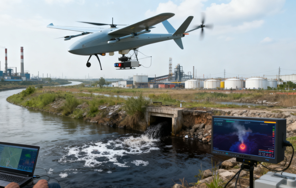
How Drones Improved Pollution Source Detection and Environmental Enforcement
Project Overview
A chemical industrial park with 32 chemical enterprises had long faced challenges in identifying hidden pollution discharge.
Traditional environmental inspections relied heavily on personnel visiting factories individually and conducting on-site checks. This approach was time-consuming and made it difficult to continuously monitor a large and complex industrial area.
On average, traditional inspections identified only 2–3 hidden pollution points per year.
Fixed monitoring stations provided continuous monitoring at designated locations, but their coverage was limited and could leave blind spots between monitoring points.
To improve pollution source detection and environmental supervision, the local ecological and environmental department introduced a vertical take-off and landing fixed-wing drone pollution monitoring system in 2024.
The system established a new “air-ground coordination” enforcement model, combining aerial drone monitoring with ground-based environmental inspection.
Drones can provide a broader aerial perspective of the industrial park, helping environmental authorities identify potential abnormal emissions and suspicious areas before ground teams conduct targeted inspections.
The Challenge
Large Number of Chemical Enterprises
The industrial park contains 32 chemical enterprises, creating a complex environmental supervision environment. Inspecting each enterprise individually requires significant personnel and time.
Hidden Pollution Discharge
Some pollution discharge activities may not be immediately visible during conventional inspections. This makes hidden pollution sources particularly difficult to identify through routine ground patrols alone.
Limited Inspection Efficiency
Traditional inspection teams must visit individual factories and conduct on-site investigations. The relatively low detection rate of 2–3 hidden pollution points per year highlights the difficulty of identifying concealed environmental violations through conventional inspection methods.
Fixed Monitoring Blind Spots
Fixed monitoring stations can provide continuous data from designated locations, but they cannot necessarily cover every area of a large industrial park. Potential pollution sources located outside monitoring points may therefore remain undetected.
Need for More Targeted Enforcement
Environmental authorities need a way to identify potential problem areas quickly and then direct ground inspection resources toward locations requiring further investigation.
The Drone Pollution Monitoring Solution
To address these challenges, the local ecological and environmental department introduced a VTOL fixed-wing drone pollution source monitoring system in 2024.
The system established an air-ground coordinated environmental enforcement model.
Instead of relying exclusively on fixed monitoring stations or conducting broad manual inspections, the workflow combines:
Aerial Drone Monitoring
↓
Potential Pollution Source Identification
↓
Targeted Ground Inspection
↓
On-Site Verification
↓
Environmental Enforcement
Drones provide aerial monitoring across the industrial park, while ground teams conduct detailed inspections of areas identified as potentially abnormal. This creates a more targeted and flexible approach to environmental supervision.
How the Air-Ground Coordination Model Works
1. Plan Aerial Monitoring Missions
Drone flight routes are planned according to the industrial park layout, enterprise distribution, environmental monitoring requirements, and areas requiring additional attention.
2. Conduct Aerial Monitoring
The VTOL fixed-wing drone conducts aerial patrols across the industrial park. The aerial perspective allows monitoring teams to observe areas that may be difficult to assess efficiently through ground patrols alone.
3. Identify Potential Abnormalities
Drone monitoring data is analyzed to identify potential abnormal areas or suspected pollution sources. This helps environmental authorities narrow down areas requiring further investigation.
4. Direct Ground Inspection
Once a potential problem area is identified, environmental enforcement personnel can conduct targeted on-site inspections. Instead of checking every location with the same intensity, ground resources can be directed toward higher-priority areas.
5. Verify Pollution Sources
Ground teams investigate the identified location and verify whether an actual environmental violation or pollution source exists.
6. Support Environmental Enforcement
The combination of aerial monitoring and ground verification provides environmental authorities with additional information for enforcement decisions and subsequent environmental management.
Key Technologies
VTOL Fixed-Wing Drone
The vertical take-off and landing fixed-wing platform can operate without conventional runways while providing the flight capabilities required for monitoring larger areas.
Aerial Pollution Source Monitoring
Drone-based monitoring provides an aerial perspective that can complement fixed monitoring stations and conventional ground inspections.
Air-Ground Coordination
Aerial monitoring and ground inspection work together rather than operating as separate processes. The drone identifies potential areas of concern, while personnel conduct detailed verification on the ground.
Targeted Environmental Inspection
Potential problem areas identified through aerial monitoring can be prioritized for further investigation.
This helps make better use of environmental enforcement resources.
Project Results
Broader Environmental Monitoring
Drone-based aerial monitoring provides environmental authorities with an additional monitoring method beyond fixed stations and manual factory-by-factory inspections.
Improved Detection of Potential Hidden Pollution
The aerial perspective helps environmental teams identify areas that may require further investigation, particularly where conventional monitoring coverage is limited.
More Targeted Ground Inspections
Instead of relying entirely on broad manual patrols, ground inspection teams can focus on locations identified through aerial monitoring.
Reduced Monitoring Blind Spots
Drone patrols complement fixed monitoring stations by providing flexible aerial coverage across areas that may not be directly covered by stationary monitoring equipment.
More Efficient Enforcement Workflow
The air-ground coordination model connects potential problem identification with targeted on-site verification, creating a more structured environmental enforcement process.