How Precision Drone Spraying Reduced Farm Costs by 30%
In some rural areas of Fujian province, China, traditional pesticide application mainly relies on manual labor. This approach is not only inefficient but also prone to uneven spraying, pesticide waste, and high labor costs. In large-scale seed rice cultivation, manual spraying often requires long operation cycles, making it difficult to complete pest and disease control in a timely manner. In addition, there is a lack of real-time monitoring of soil nutrients and crop growth conditions.
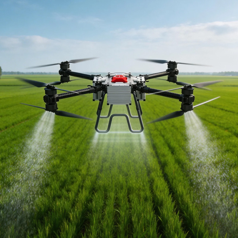
To improve agricultural production efficiency, reduce cultivation costs, and promote smart agriculture development, the local farm introduced agricultural drones equipped with multispectral sensors, establishing a precision spraying and digital field management system.
Project Challenges
Before implementation, the farm faced several key challenges:
- Manual spraying was inefficient and time-consuming.
- Pesticide distribution was uneven, leading to low utilization efficiency.
- Large-scale farmland management was difficult and labor-intensive.
- There was no real-time crop health monitoring capability.
- Soil nutrient conditions could not be accurately assessed.
- Rising labor costs placed increasing pressure on traditional farming models.
For approximately 300 mu of seed rice fields, traditional manual spraying typically required around 10 days to complete.
Solution
The development of this project utilized an integrated approach that incorporated the use of agricultural drones along with multi-spectral remote sensing technologies, which allowed for precision spraying and crop monitoring. Through the combination of these technologies, precision spraying and real-time farm monitoring became possible.
Core Technologies
In order to achieve the project goal, it developed an agricultural intelligent system based on the use of drones. This includes the low altitude autonomous drones for agricultural use, enabling the implementation of automation for spraying pesticides as well as following routes effectively. The multispectral sensor monitoring technology was applied to gather the spectral data of the crops and soil status.
Moreover, it was equipped with soil nutrients monitoring and analysis capabilities. The crop health monitoring function allows the identification of the areas which need special attention due to growth issues. Lastly, the digital farmland mapping module is used to visualize the gathered information.
Implementation Process
They flew independently through pre-programmed flight paths, controlling their flying height, velocity, and atomization parameters to ensure consistent pesticide distribution and enhanced efficiency.
While in operation, the sensors captured important data on the state of the soil nutrients, crop growth patterns, the health condition of plants, and areas susceptible to pest infestation, creating multi-dimensional data sets.
Through the analysis of such data sets, farmland maps were created to help farmers know the condition of the farmland in an attempt to make informed decisions about fertilizing and pest control measures.
Project Results
After implementation, the project achieved significant improvements in agricultural productivity, cost control, and environmental sustainability.
Significant Efficiency Improvement
Pesticide spraying time for 300 mu of seed rice fields was reduced from 10 days to 3 days, greatly improving operational efficiency. Labor intensity was significantly reduced, decreasing reliance on seasonal workers while enhancing large-scale farm management efficiency.
Cost Reduction
Overall operational costs were reduced by approximately 30%. More precise pesticide application reduced waste and improved resource utilization. Seasonal labor input costs were also significantly lowered, optimizing the agricultural production structure.
Environmental Benefits
Precision spraying effectively reduced excessive pesticide use and minimized pesticide drift, thereby lowering environmental pollution risks and supporting more sustainable agricultural practices.
Enhanced Digital Management Capability
Real-time monitoring and dynamic updates of farmland conditions were achieved through systematic data collection and analysis, improving overall decision-making efficiency. Farmers were also able to identify potential risks earlier, reducing uncertainty and potential losses in crop production.
Project Summary
The integration of agricultural drones, multi-spectral remote sensing technology, and digital land management technology makes the success of changing from manual pesticide spraying to intelligent precision agriculture possible.
Not only is this example very effective in enhancing agricultural efficiency, but it also offers a feasible model for the digitalization and intelligence development of agriculture.