Application of Autonomous Inspection Drone in Vineyards
Managing vineyards includes constant monitoring of vine condition, canopy formation, irrigation status, and disease risk. Traditional surveys take much time especially for huge vineyards with narrow rows and difficult terrain. Autonomous inspection drone provides another way to inspect which uses programmed flights, high-quality imagery, and georeferencing.
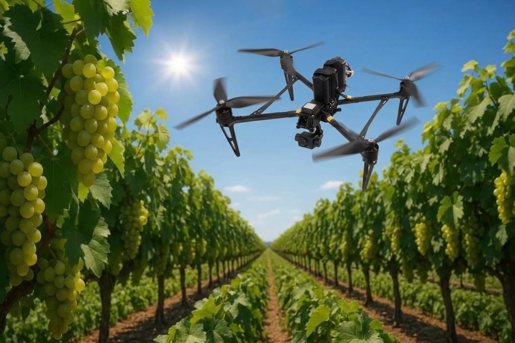
Choosing an autonomous inspection drone for agricultural technology companies and equipment users is not just about obtaining images from the air. The drone should be capable of moving through rows, provide high quality images, avoid obstacles, and gather comparable data on each survey.
Table of Contents
Why Vineyards Need Autonomous Inspection Drones
Vineyards create many problems for autonomous unmanned aerial vehicle flights. Row spacing at around 1.5 to 2.0 m makes small deviations highly problematic in terms of clearance above the grape vines. There are also trellis wires, posts, uneven ground levels, and increased canopy density to consider.
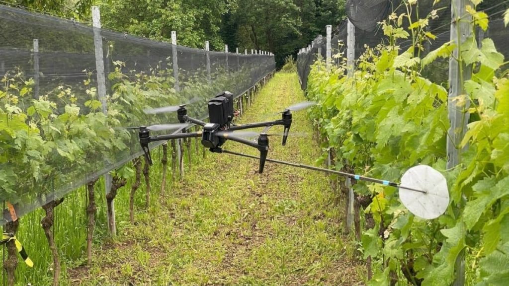
An interesting project which has been talked about on the Reddit forum is related to an automated surveying of vineyards by leaf imaging and 3D mapping from a close range. Image resolution, positioning precision, obstacle avoidance, and flight efficiency have to be balanced in such processes. The nearer flying to the canopy is the better image resolution but also the higher collision risk.
Operation must be achieved through synchronized navigation and imaging approaches. The use of RTK GNSS facilitates the repeatability of positioning, while the use of visual SLAM and depth sensors helps with local navigation and obstacle avoidance. The camera angle, lighting conditions, flying speed, and image overlap should be determined by the purpose of the mission being carried out.
Key Applications in Vineyard Monitoring
Canopy Inspection and Crop Stress Detection
Autonomous inspection drones can take specific paths over vineyard rows to gather information about the canopy density, gaps in vegetation, plant development, and the presence of any leaf injury. This information is accumulated over time for comparison.
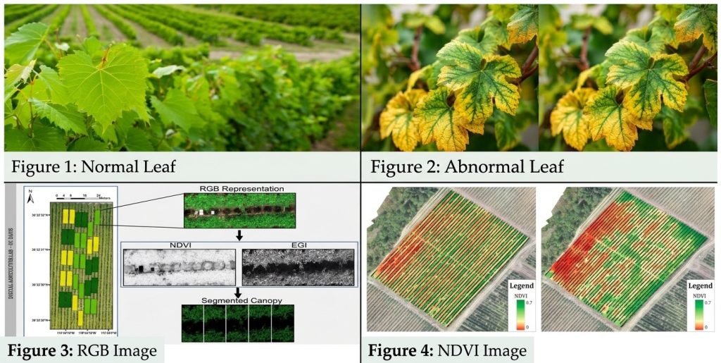
The RGB camera can detect visible signs such as discoloration and damaged leaves. Multispectral imaging will add more data from wavelength bands to detect spatial variation in plant health.
The NDVI index, for instance, can give an indication of the variation in plant health, but it does not confirm whether the vines have problems due to disease, nutrition or drought.
Three-Dimensional Mapping
Images taken with overlapping can be used to create orthomosaics, point clouds, and three-dimensional models. This will aid in recording the structure of the canopy, recognizing gaps, and analyzing any changes in the shape of the vineyard.
A previously published precision-viticulture study performed UAV-based surveys at an altitude of about 70 meters above ground level, thereby reaching a resolution of about 1 cm/pixel for the RGB images and 4 cm/pixel for the multispectral images. The image overlap employed was greater than 80% both laterally and forward.
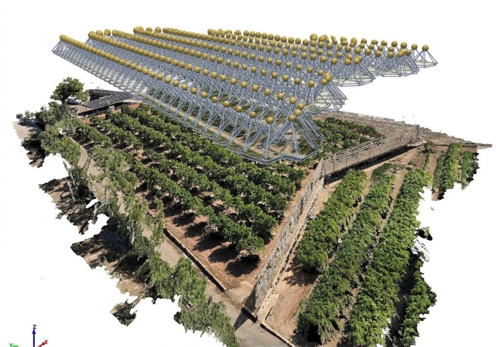
This is just one possible design for aerial mapping; there are no hard-and-fast rules. For leaf-level analysis from an aircraft, a different set of design parameters must be considered depending upon resolution, working distance, field of view, and flight velocity.
Autonomous Navigation Between Vineyard Rows
Inspection by autonomous drone in vineyards needs good positioning and detection capabilities around vegetation and trellis systems. The RTK GNSS system allows good positioning with waypoints and georeferencing, while visual SLAM, stereo vision, or LiDAR could help in local navigation under occluded satellite signals.
The VastArrive VA-FPVD13 is characterized by a 13-inch wheel, 593 mm wheelbase, 489 × 489 × 80 mm measurements, and 3K T300 carbon fiber body. This small-sized robot serves as an example for assessing clearance and maneuverability between rows of vineyards.
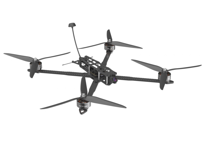
But autonomous operations require more than just knowing the size of the airframe. Integration of RTK, computing, and obstacle detection sensors must also be tested to ensure that they will work with the inspection aircraft.
Camera Selection and Image Acquisition Parameters
Camera choice depends on what needs to be inspected. RGB cameras are for inspecting canopies, while multispectral cameras are needed for vegetation index analysis. On the other hand, close leaf inspection will need appropriate focus, exposure, shutter speed, and motion handling.
Optional night-vision FPV camera with 1800TVL for the VastArrive VA-FPVD13 is available. It could be that precise vineyard mapping would need a further attachment in the form of an RGB or multispectral camera.
In photogrammetry, an overlap of about 70-80 percent can be a starting point for planning purposes, depending on terrain, sensors, and other factors. Overlap increases precision but increases data size at the same time. Ground sampling distance is also determined by several factors including the sensor itself, lens used, and flight height; just having a 20 megapixel camera does not mean 1 cm per pixel resolution.
Flight Endurance and Mission Planning
Endurance plays a critical role in terms of vineyard coverage and mission planning. According to the VastArrive VA-FPVD13, the recommended battery to use is X8S 16000 XT90, which according to the manufacturer gives a flying time of 15-35 minutes. In terms of mission planning, one needs to include entry and exit to the row, turning points, home returning points, and safety points. This can be done using a phased approach whereby the first step is an aerial survey and then inspection of selected rows.
Evaluating an Autonomous Vineyard Inspection System
The evaluation of an operational test must go beyond just measuring the number of rows that can be flown. Other factors to be measured are lateral path deviation, repeat position accuracy, image clarity, obstacle evasion, mapping success, and area surveyed per battery cycle.
When using open source flight control platforms such as ArduPilot and PX4, other testing elements that need to be done include waypoints, camera triggers, telemetry, failsafes, and compatibility with image processing onboard hardware.
In the early stages of testing, the paths used should be controlled before moving on to more complex flights including dense canopies and slopes.
Conclusion
Autonomous inspection drones can help make vineyard inspection more systematic using repeatable flying paths, high-quality images, and georeferencing. The efficiency of the drone is determined by how well the frame, navigation system, imaging unit, and data processing are suited for this task.
The agricultural machinery manufacturer and integrator can begin their assessment of such systems based on the characteristics of such platforms as the VA-FPVD13. To make an efficient application of a drone for vineyards, the performance of the payload integration, positioning system, and obstacle avoidance should be verified on-site.