How Crop Health Monitoring Drones Are Transforming Precision Agriculture?
Due to the advancement of global agriculture into a more high-tech industry with intelligent agriculture, the challenges faced by farmland management are becoming more and more complicated; for example, there is a more frequent outbreak of pests and diseases, poor water distribution, nutritional imbalances in the soil, and increasing labor costs.
The conventional field inspections manually carried out by humans are not only inefficient but also find it difficult to identify problems faced by crops at an early stage, hence causing more damage than necessary.
Under these circumstances, crop health monitoring drones have been adopted into modern agriculture and have become one of the crucial tools for farmland management through quick scans of the farmland.
How Do Crop Health Monitoring Drones Work?
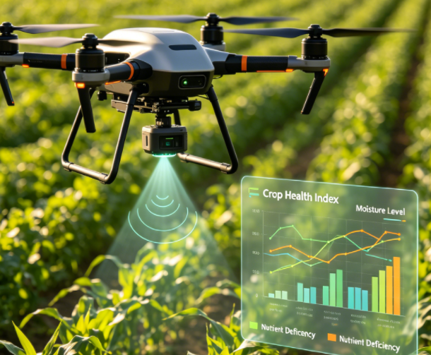
Crop health monitoring drones typically operate through four main stages: data collection, data analysis, AI-based recognition, and visual output, enabling fast and precise farmland monitoring.
1. Farmland Data Collection
Prior to conducting the mission, the drone creates an appropriate flying route according to the area of the field and the geographical characteristics of the land, followed by autonomous flight according to specific altitude and speed.
In addition to acquiring visual data, the drone will be installed with RGB cameras and multispectral instruments so that it can acquire invisible plant information, which serves as a basis for later analysis.
2. Image and Data Analysis
Following the gathering process, the collected data is uploaded to a farming analytics portal where the images are processed through the processes of stitching, correcting, and standardizing.
The software normally analyzes the state of the crops based on vegetation indices such as NDVI. In turn, depending on the differences in the obtained numbers, it will be able to analyze whether the crops have any problems or not.
3. AI-Based Intelligent Recognition
On top of data analysis, artificial intelligence algorithms are used to further identify and classify abnormal areas in the field.
The system can quickly detect issues such as:
- Pest and disease-affected zones
- Water-deficient or irrigation-stressed areas
- Uneven growth or abnormal crop development
Compared with traditional manual field inspection, AI-based recognition significantly improves efficiency while reducing errors caused by subjective judgment.
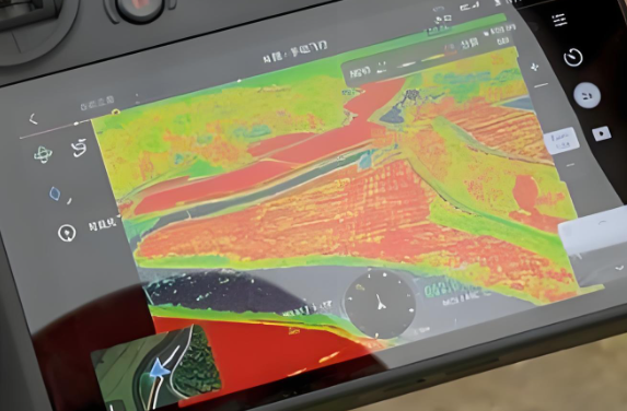
4. Generation of Crop Health Maps
Finally, a crop health map is created that makes use of colors to depict various conditions on the farm.
In such cases, for instance, the color green stands for a good growth rate, while yellow shows mild problems that need some consideration. The color red, on the other hand, depicts problem areas that need to be acted upon urgently.
Key Advantages of Crop Health Monitoring Drones
Crop health monitoring drones play an increasingly important role in modern precision agriculture. Their advantages are mainly reflected in improved efficiency, early pest detection, cost reduction, and yield optimization.
1. Improved Monitoring Efficiency
Traditional monitoring involves considerable effort, particularly when conducted manually. The process is extremely labor-intensive and can be highly challenging for a large farmland since conducting an overall assessment and inspection cannot always be performed in a timely manner. With drones, it is possible to survey tens or even hundreds of hectares of farmland promptly and follow predetermined flight patterns.
Such an efficient monitoring system allows farmers to save plenty of costs and frequently perform surveys in order to get more information on their crops’ condition.
2. Early Detection of Pests and Diseases
In the early stages of pest infestations or crop growth abnormalities, visual symptoms are often not easily detectable by the human eye. However, drones equipped with multispectral and thermal imaging sensors can capture subtle signals such as changes in leaf reflectance, temperature anomalies, and declining vegetation indices.
Through data analysis, the system can issue early warnings before pests and diseases spread on a large scale, giving farmers valuable time for timely intervention and reducing potential losses.
3. Decreased Agricultural Expenses
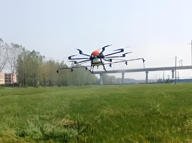
With accurate monitoring and analyzing data, drones aid in resource management. For instance, the targeted spraying of pesticides and fertilizers ensures that they are applied solely where needed without being excessively applied.
On the other hand, reduced manual inspections lead to lower labor expenses. Moreover, better irrigation and spraying of fertilizers ensure optimal efficiency of water and agricultural input use, hence lowering expenses.
4. Improved Harvesting Volume
In view of accurate information offered by drones, farmers adopt customized agricultural practices for various zones on their farms. Such customized practices may include better fertilizer application or irrigation techniques among others.
This technique contributes to improved growing conditions which reduce variations in crop growth and increase crop quality and volume.
Applications: How Drones Are Transforming Modern Agriculture
Drones for crop health monitoring have been extensively used in a variety of farming practices. These are vital elements of precision farming today since their use helps farmers transition from knowledge-based farming techniques to data-farming.
1. Crop Field Monitoring on Large Farmlands
Manual field monitoring of farmlands consumes lots of time and manpower, and may be ineffective. With the use of crop health monitoring drones, thousands of acres of crops can be monitored at once.
The use of multiband and highly detailed imaging allows farmers to distinguish:
- Areas with strong and healthy crop growth
- Zones showing delayed or uneven growth
- Potential stress areas that are not visible to the naked eye
This bird’s-eye perspective allows farm managers to quickly detect spatial differences across fields and make more informed decisions, significantly improving operational efficiency.
2. Irrigation System Optimization
Water management plays a critical role in agricultural productivity, and drones offer a highly effective way to optimize irrigation strategies.
By using thermal imaging and vegetation index analysis, drones can detect:
- Areas with insufficient soil moisture
- Over-irrigated zones that may lead to water waste
- Uneven water distribution caused by irrigation system inefficiencies
Based on these insights, farmers can implement precision irrigation—applying water exactly where it is needed. This not only reduces water consumption but also ensures more balanced crop growth and improved yields.
3. Early Pest and Disease Detection
One of the most valuable applications of crop monitoring drones is early detection of pests and diseases. Many crop issues begin with subtle changes that are difficult to identify with the naked eye.
Drones can detect early warning signs such as:
- Slight color variations in leaves
- A decrease in vegetation index (NDVI) in specific areas
- Abnormal temperature patterns in affected zones
When combined with AI-based analysis, these signals can help identify potential problem areas before the damage spreads. This enables farmers to take targeted action early, reducing crop loss and minimizing the need for large-scale pesticide use.
4. Precision Fertilization Management
Traditional fertilization methods often rely on experience, which can lead to over-application or under-application of nutrients. This not only increases costs but may also harm soil health and environmental sustainability.
With drone-generated field data, farmers can develop precise fertilization strategies, such as:
- Identifying areas that require additional nitrogen or nutrients
- Detecting zones with sufficient fertility that need less input
- Adjusting fertilizer application rates based on real crop conditions
This precision approach improves fertilizer efficiency, reduces waste, and supports more sustainable agricultural practices.
5. Agricultural Research and Data Analysis
In agricultural research, crop health monitoring drones provide valuable long-term datasets for scientific analysis and experimentation.
Researchers use drone-collected data to:
- Compare different crop varieties under real field conditions
- Study the impact of climate change on agricultural productivity
- Evaluate the effectiveness of different fertilization and irrigation strategies
- Monitor ecosystem changes in agricultural environments
By continuously collecting high-quality field data, drones help bridge the gap between agricultural theory and real-world farming practices, accelerating innovation in modern agriculture.
Core Comparison: How Drones Bridge the Gap in Precision Agriculture
Whereas conventional farmers are often caught between the dilemma of opting for either the “eye-in-the-sky” approach, using satellite images, or the “feet-on-the-ground” method involving manual inspection, drones have proved themselves to be the “golden pillar” in the domain of precision agriculture by effectively filling the technological gap.
A. Spatial Resolution: From “Pixels” to “Plants”
Satellite Images: Regardless of their rapid evolution, the GSD of commercial satellites still lies within the range of 3 to 10 m/pixels. Thus, each pixel may include several dozen plants, which makes it extremely difficult to spot even early signs of crop stress.
Manual Inspection: Although it offers maximum sharpness, manual inspection doesn’t allow a person to measure plant reflectance values by merely relying on their eyesight, while it is physically impossible to retain an overall “bird’s-eye view” across many hundreds of acres.
Agricultural Drones: By flying much closer to the ground level, drones provide a resolution of 2-5 cm/pixels, making it possible to track the condition of each plant separately, including any signs of curling leaves or discolorations.
B. Flexibility and Timeliness: Eliminating “Weather Dependency”
Satellite Imagery: Satellites are bound by fixed orbital paths, with revisit cycles that can take days or weeks. More importantly, cloud cover is a fatal flaw; during critical rainy seasons, persistent clouds often render satellite monitoring completely useless.
Agricultural Drones: Drones offer “on-demand” deployment. As long as wind speeds are within safety limits, drones can fly beneath the clouds to capture up-to-the-minute data. For sudden pest outbreaks, this rapid response time is the difference between saving a harvest and total loss.
C. Data Depth: Analysis Beyond the Visible Spectrum
Conventional Approaches: Manual scouting and satellite imagery both depend heavily on the RGB spectrum of light.
Agricultural Drones: With the help of special multispectral or thermal cameras, drones operate outside the visible light spectrum range. The near-infrared (NIR) light spectrum helps analyze the physiological processes in the cell structure and chlorophyll content in plants, detecting stress 3-5 days earlier than the visible signs of damage become visible to the naked eye.
D. Economic Efficiency and ROI
Economic Drawbacks of Conventional Methods: Manual scouting is not economically viable due to the expensive labor input. While satellite services are more affordable, the user still needs to pay for a premium subscription to receive detailed data.
Benefits of Drones: Although there will be some upfront investments in hardware costs, the operational costs are very low since it takes little time and energy to fly one flight mission. The savings generated by using less fertilizers (thanks to the VRA technique) and pesticides result in full ROI within 1-2 seasons.
| Feature | Satellite Remote Sensing | Manual Scouting | Agricultural Drones (UAV) |
| Spatial Resolution | Low (3-10m/px); loses fine detail | Highest (Individual leaf level) | Ultra-High (1-5cm/px); individual plant focus |
| Environmental Constraints | Blocked by clouds; rigid orbital cycles | Limited by terrain, stamina, and daylight | Flights under cloud cover; high mobility |
| Data Metrics | Macro trends; basic NDVI only | Subjective; lacks quantifiable data | Advanced (NDVI, NDRE, LCI, Thermal) |
| Timeliness | Significant delay; scheduled data | Extremely slow for large-scale farms | Real-time; models generated within hours |
| Long-term Cost | High recurring subscription fees | High labor and time intensity | One-time investment; minimal operational cost |
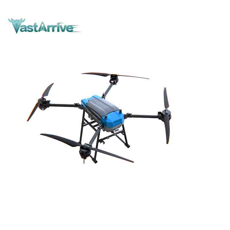
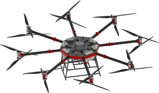
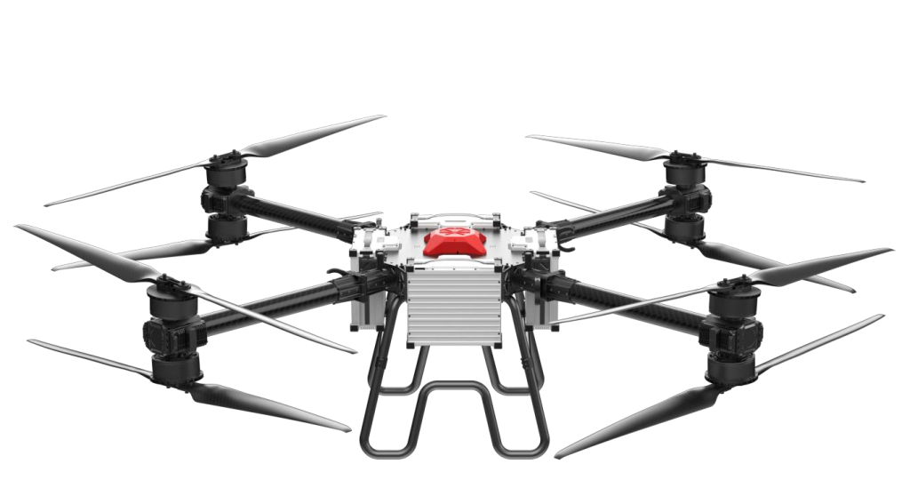
Best Drones for Crop Health Monitoring: VastArrive Agriculture Drones
Agriculture drone provided by VastArrive offer a wide range of capabilities that include crop monitoring, irrigation management, and interventions in the field through precise spraying. Our unmanned aerial vehicles allow agribusinesses and farmers to increase efficiency, conserve resources, and achieve maximum effectiveness in managing their land using precision agriculture techniques.
From soil analysis and planting optimization to crop spraying and real-time monitoring, VastArrive agriculture drones provide end-to-end support across the entire farming cycle. These intelligent solutions enable more accurate decision-making, healthier crop growth, and more sustainable agricultural production from field to harvest.
If you are looking for the best drones for crop health monitoring, you can rely on VastArrive.
Related Products