
Drone for Wildlife Monitoring: How is It Used?

With the rapid development of Unmanned Aerial Vehicle (UAV) technology, drones are increasingly expanding into environmental protection, scientific research, and wildlife monitoring. Compared to traditional methods that rely on manual patrols, ground surveys, or even manned helicopter aerial surveys, drones offer lower costs, higher efficiency, and minimal disturbance when executing large-scale monitoring tasks. Consequently, they are gaining immense popularity among conservation organizations, research institutions, and government agencies.
Whether counting large mammals in forests, observing migratory birds in wetlands, or using thermal imaging technology at night to detect poaching, drones have demonstrated unparalleled advantages over traditional monitoring methods.
This article provides a detailed breakdown of the applications, advantages, key features of wildlife monitoring drones, and how to select the right device for your needs.
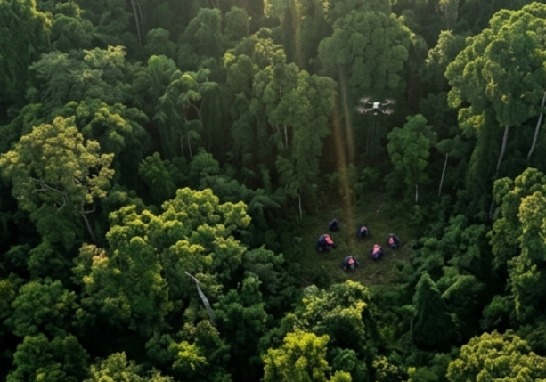
Table of Contents
Why Do More Organizations Tend to Use Drones for Wildlife Monitoring?
More research centers, wildlife reserves, and environment conservation organizations tend to use drones as an alternative to traditional observation techniques. And the basic reason behind their adoption is the fact that drones address the pain points associated with traditional field observation, which include inefficiency, risks, high costs, and risk of disturbing animals.
The main benefits offered by drones include:
1. More Efficient Monitoring
The traditional manual monitoring is constrained by physical endurance and environmental factors and hence, only manages to cover a few kilometers per day. However, a drone can cover scores and even hundreds of kilometers squared within one flight, thus reducing days of work to just tens of minutes. Drones, therefore, are best suited for quick population estimation of animal groups as well as patrols.
2. Low Impact on Animals
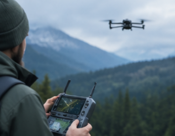
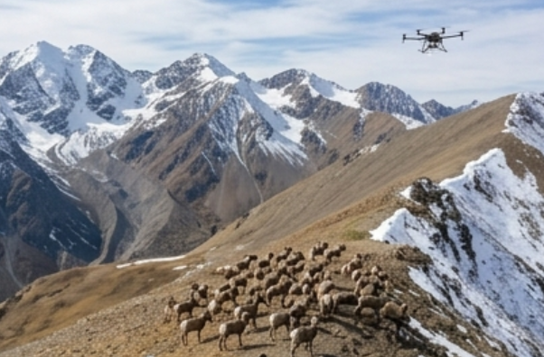
Drones fly at safe heights of 60 – 100+ meters. They are equipped with powerful optical zoom cameras which enable them to record natural activities of animals without being noticed. This not only minimizes human scent and noise disturbance but also prevents triggering stress responses in animals.
3. Lower Survey Costs
The cost involved in renting manned and expensive helicopters with rigid scheduling is way higher than that involved in buying and maintaining drones. Moreover, unlike fixed infrared camera traps which demand frequent manual extraction of SD cards, drones are easy to deploy and therefore minimize long-run costs.
4. Improved Safety of the Staff
It is easier to maneuver across cliffs, thick jungles, swamps, glaciers, and many other dangerous zones using drones. When carrying out the surveillance of dangerous and aggressive creatures such as brown bears or wild elephants, the researchers can do it remotely kilometers away without risking themselves in the wild.
5. Combination of Thermal Imaging and Artificial Intelligence for Nighttime & Smart Monitoring
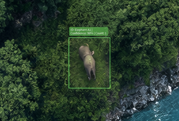
Drones equipped with thermal imaging technology are able to penetrate through darkness and canopy layer and detect the location of nocturnal animals or even poachers based on their body heat signatures. In combination with AI algorithms, drones will be able to recognize and count population on their own.
What Key Features Should a Wildlife Monitoring Drone Have?
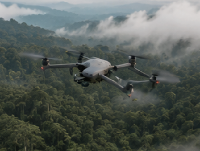
Wildlife monitoring is not a task for consumer-grade drones; the complex weather and terrain in the wild demand high-level professional performance. When selecting equipment, focus on the following core features:
Long Endurance and Extended Flight Range:
Increased flying time minimizes the problem of interruptions due to constant battery changes and increases the area of the terrain being covered, making surveys more efficient. For field conditions that are quite complicated, it is suggested to use a multi-rotor UAV with at least 40 minutes (for multi-rotors) and 2 hours (for fixed-wing/VTOL UAVs) of flying time.
High Definition Zoom & High Resolution Camera:
Clear imagery is the foundation of scientific data collection. Look for cameras supporting 4K video recording and 20+ megapixels. More importantly, the camera should feature high-power optical zoom (30x or higher). This enables researchers to capture clear details of animal skin, injuries, or ear tags from safe altitudes over 100 meters away without disturbing the animals.
Thermal Imaging and Multi-Sensor Fusion:
A thermal imaging sensor is an indispensable piece of equipment that penetrates through darkness, fog, and thick bushes and detects animals depending on their temperatures. Modern commercial professional systems have multi-sensor systems (visible light and thermal imaging), which facilitate real-time side-by-side comparisons and are extremely helpful for night-time anti-poaching patrols.
Flight Planning and Autonomous Cruise:
A professional drone should have the Waypoint Flight and Grid Mapping capabilities. As soon as flight paths and overlap percentages are pre-programmed, a drone performs completely autonomous flights and provides excellent consistency of seasonal survey paths, which allows long-term ecological comparisons.
Wind Resistance and Tough Protection in Rough Fields:
A considerable number of nature reserves are situated in mountains, plateaus, or coastal regions with changing weather. The equipment must have at least wind resistance class 6 to ensure consistent flight attitude and no vibrations in imaging. Moreover, the body of the device must be protected against rain, moisture, extreme coldness or sandstorm at the IP55 or higher level.
High Precision Positioning with RTK and Alignment in Centimeters:
Incorporation of an RTK module increases positioning accuracy of the drone up to the centimeter. RTK is essential for scientific research as it Geo-tags all photos taken from the air. Thus, it becomes easy to use the images in GIS software in order to map species’ spatial distribution and habitat degradation modeling.
Traditional Monitoring vs. Drone Monitoring Comparison
| Monitoring Dimension | Traditional Manual Patrol | Infrared Camera Traps | Drone Monitoring (UAV) |
| Coverage Area | Small (Micro-level Inspection) Limited by stamina and terrain; covers only a few kilometers of transects per day. | Point-based / Fixed Field of view is restricted to tens of meters in front of the lens; requires dense placement for large areas. | Extremely Broad (Macro-level Patrol) A single flight can quickly cover dozens to hundreds of square kilometers. |
| Data Timeliness | Delayed (Manual Recording) Relies on paper records or manual entry; post-survey processing is time-consuming. | Lagging (Periodic Retrieval) Requires personnel to visit the field periodically to retrieve SD cards, resulting in months of delay. | Real-Time (Instant Transmission) Streams high-definition video and geographic coordinates instantly via 4G/5G/data links. |
| Disturbance to Wildlife | High (Overt Disturbance) Human scent, footsteps, and body heat easily trigger animal stress and evasive behaviors. | Extremely Low (Covert Observation) Stationary on trees with no smell or noise; causes almost zero disruption to animal behavior. | Low to Extremely Low (Spatial Isolation) Flies quietly at 60–100m altitudes; high-zoom lenses enable non-intrusive remote monitoring. |
| Terrain Adaptability | Poor (Severely Restricted) Cliffs, dense forests, swamps, and glaciers are impassable for humans. | Moderate (Human-accessible) Can only be deployed in areas reachable by survey personnel on foot. | Excellent (3D Spatial Mobility) Ignores ground terrain obstacles completely; easily traverses steep cliffs, wetlands, and roadless zones. |
Common Applications in Wildlife Tracking
With advancing drone technology, applications have progressed from mere photography to full-scale automation involving monitoring, alerting and protection mechanisms. They enhance the field of view of the researchers and transform wildlife conservation efforts from reaction to action.
1. Census of Population and Their Spatial Distribution
Counting animals that live in clusters on grasslands, marshlands or islands through manual means results in significant errors. The drones perform aerial surveys using grid system flights in predetermined routes. Coupled with AI software, they can successfully count many tens of thousands of migratory birds or even large mammals and map their spatial distribution in just a few hours.
2. 24-Hour Anti-Poaching Patrols
Most of the poaching activities take place during the night time or around the perimeter of the wildlife sanctuary. The drone with thermal imaging and obstacle detection performs automatic night-time patrols. On spotting any suspicious activity, such as people or vehicles entering into the area, the system automatically tags the location.
3. Habitat Assessment and Nest Monitoring
In the case of endangered birds such as raptors who build nests either in cliffs or tall tree canopies, the drone is capable of capturing high-resolution images for monitoring the nest building, egg laying, and chick hatching process.
4. Post Disaster Rescue and Emergency Response
In case of disasters such as forest fires and floods, emergency response drones can immediately move into smoke-filled areas in order to assess the extent of damage caused, find trapped or injured animals and supply emergency rescue workers with immediate on-field data and navigation routes.
Challenges of Wildlife Monitoring Drone and Solutions
Although there have been tremendous innovations introduced by drones for wildlife monitoring, there are many difficulties that may be encountered when operating in the field.
Preventing Disturbance to Wildlife
The sound generated by the engines and the mechanical look of the drones may alarm the animals, resulting in stress or even attacks on the drones.
Fly at a Safe Height: Ensure that the height is strictly maintained between 60-120 meters above the ground (with regards to the sensitiveness of different species). For those that are sensitive to sound, keep flying at a height higher than 100 meters and use powerful zoom lenses.
Fly with a Slant: Do not approach animals vertically, since it resembles a predatory attack coming from the sky. Rather fly at a slant with a constant height and speed.
Fly Low-Noise Equipment & Optimal Time: The installation of low-noise propellers in drones is very important, as well as flying at optimal times, especially during peak feeding times.
Power Supply in Remote Off-Grid Areas & Extreme Environments
Reserves in the field are typically distant from power networks, creating problems with constant maintenance and operations.
Build a Hierarchical Power System: Provide teams with high-capacity portable power stations (2000Wh or higher recommended) along with foldable solar panels for constant charging.
Backup Generators and Inverters: To maintain operations over several days and at high intensity, take inverters that utilize car batteries or portable fuel generators.
Battery Thermal Management: Altitude and cold weather reduce efficiency of lithium batteries. Use smart flight batteries with self-heating functions and keep batteries insulated prior to takeoff.
Legal Compliance and Airspace Clearances
Nature reserves and borders require rigid airspace restrictions; any flights in these regions without clearance can attract heavy penalties or liabilities.
Apply for Permissions Ahead of Time: Before starting, apply for permission in the form of flight permissions and entry permissions in nature reserves with the natural resources departments, forest and grassland departments, and airspace control authorities.
Applications for BVLOS Flights: Ecological surveys on a large scale often employ BVLOS flights, thus necessitating airspace clearances and BVLOS flight permissions.
Security and Privacy of Data: Locations of endangered animals must always remain encrypted to prevent any data leakage to the poachers.
How to Select the Right Wildlife Monitoring Drone?
The selection of an appropriate drone system needs an accurate matching of operational scenario and drone specifications. More specifications and more expensive drones do not necessarily perform better for your requirements – over-estimation is a waste of budget and weight in the field.
Step 1: Specify Monitoring Scenarios and Environment
Small Area / Fixed Point Observation and Dense Forest Monitoring: Select a Multi-Rotor Drone. This type provides flexible hovering capability and VTOL with high maneuverability for short-distance monitoring, nest monitoring inside canopy and take-off from clearings in dense forests.
Wide Reserve Monitoring, Large Populations Counting or Boundaries Checking: Select a Vertical Takeoff and Landing (VTOL) Fixed Wing Drone. VTOL drones combine long range and high-speed capabilities of fixed wing aircraft with no runways required take-off feature of multi-rotor drones.
High Altitudes, Cold Regions or Rainy and Humid Climates: Specify wind resistance (Level 6+), operating temperatures range (-20°C to 50°C), and IP55+.
Step 2: Evaluate Sensors and Payload Needs
Flying is only the transport mechanism; seeing clearly and capturing accurately is the core objective:
Daytime HD Observation & Population Counting: Requires a 4K camera with at least 30x hybrid/optical zoom to identify features clearly from safe altitudes over 100 meters away.
Night Anti-Poaching & Nocturnal Species Tracking: Must feature a thermal imaging sensor (FLIR). Thermal sensitivity of NETD ≤ 30 mK and 640 x 512 resolution are suggested for penetration through darkness and heavy tree coverage.
3D Habitat Modeling & Vegetation Analysis: Consider using LiDAR or multispectral camera for penetration through the canopy of trees for terrain mapping and degradation analysis.
Selection Tip: Opt for dual/triple sensor gimbals (Visible Light + Thermal + Laser Range Finder) to cover all-weather missions using only one payload.
Step 3: Evaluating Data Accuracy & Software Compatibility
Scientific Spatial Analysis: If aerial data is to be used in GIS for ecological modeling, then the drone has to have RTK capability to attach coordinates in centimeters to each photo.
Bulk Data Analysis: Does the system support AI Edge Computing and Automatic Flight Planning Software? AI algorithms automatically process species identification and preliminary counting, freeing researchers from manual image review.
Step 4: Evaluate Total Lifecycle Costs & Field Support
Portability & Transport: Assess folded dimensions and weight to ensure the equipment can be backpacked into roadless areas by a single operator.
Field Accessories and Power Budget: Provide budget for portable power stations, solar panel systems, 4 to 6 smart batteries, and hard cases for transportation of equipment.
Maintenance and After-Sales Support: Damage to equipment in harsh environmental conditions is an inevitable part. It is crucial to select reliable equipment brand that offers local maintenance services and spare parts.
Conclusion
Drones are revolutionizing the way wildlife is monitored by providing the researchers and conservation bodies with a safe, convenient, and economical data collection tool. With advancements in artificial intelligence, thermal imaging, and autonomous flight technologies, the drones will become even more important in protecting the wildlife and conducting their ecological monitoring in the future.
If you are looking for reliable wildlife monitoring drone solutions, VastArrive offers a range of professional drones suited for wildlife surveys, forest patrols, wetland monitoring, and environmental protection. Contact VastArrive today to learn more about our products and get a customized solution tailored to your needs.