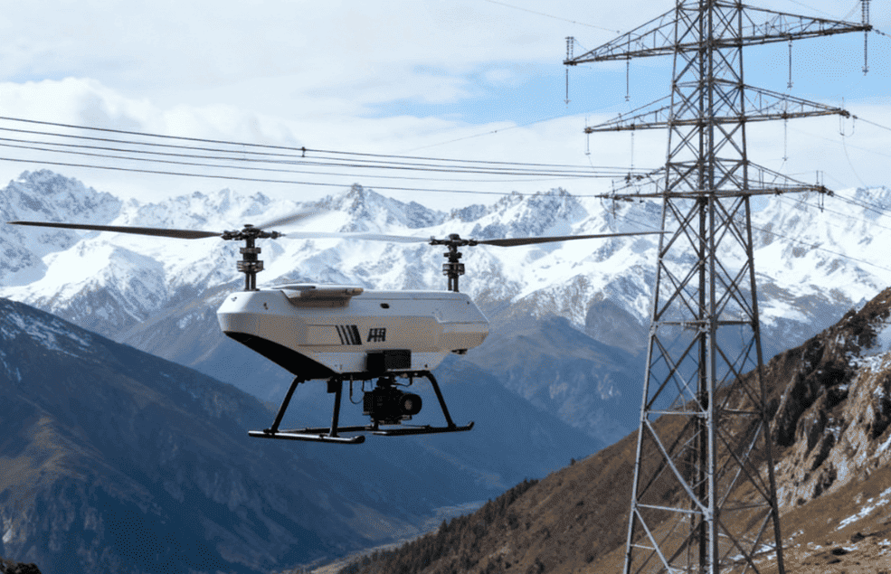
Intelligent Drone Inspection for Ultra-High Voltage Transmission Lines
Project Overview
The transmission corridor covered by this project extends for approximately 520 kilometers, crossing a wide range of complex terrain, including mountains, hills, and rivers.
Traditional inspection methods relied heavily on manual patrols. Inspection personnel needed to spend approximately 20 days per month hiking along the transmission corridor, while each tower inspection took around 15 minutes.
This inspection model created several challenges, including significant travel requirements, high work-at-height risks, and strong subjectivity in manual inspection data.
To improve inspection efficiency and reduce personnel exposure to difficult terrain and high-altitude work, the power company introduced a “multi-drone collaboration + intelligent analysis” inspection model in 2024.
The project deployed six industrial-grade drones equipped with high-definition visible-light cameras, infrared thermal imagers, and LiDAR sensors.
Together, these systems enabled autonomous inspection across the transmission corridor and provided multi-dimensional data for intelligent analysis and power line maintenance.
The Challenge
Extremely Long Transmission Corridor
The transmission line extends for approximately 520 kilometers, making comprehensive manual inspection highly labor-intensive.
Inspection teams must travel significant distances between towers and inspection locations.
Complex Terrain
The corridor crosses:
- Mountains
- Hills
- Rivers
These terrain conditions make ground-based inspection difficult and increase the time required to reach remote towers.
High Work-at-Height Risks
Traditional inspection requires personnel to approach and climb transmission towers.
Working at height creates additional safety risks, particularly when inspections are carried out repeatedly across a large transmission corridor.
Long Inspection Cycles
Under the traditional inspection model, personnel needed approximately 20 days of hiking per month to complete inspection tasks. Each tower inspection took approximately 15 minutes, making large-scale inspection operations time-consuming.
Subjective Inspection Data
Manual inspection relies heavily on personnel observation and judgment. Differences between inspectors can lead to variations in inspection records and make standardized condition assessment more difficult.
The Multi-Drone Inspection Solution
To address these challenges, the power company introduced a multi-drone collaboration and intelligent analysis system in 2024.
Six industrial-grade drones were deployed to support autonomous inspection across the transmission corridor. Each drone was equipped with multiple sensing technologies:
- High-definition visible-light cameras
- Infrared thermal imagers
- LiDAR sensors
The combination of these technologies allows the inspection system to collect visual, thermal, and spatial information from transmission infrastructure.
Rather than relying on a single inspection method, the multi-drone system provides a more comprehensive view of transmission line conditions.
How the Intelligent Inspection System Works
1. Plan the Inspection Area
The 520 km transmission corridor is divided into inspection areas according to the distribution of towers and terrain conditions. Flight missions are planned based on the transmission line route and inspection requirements.
2. Deploy Multiple Industrial Drones
Six industrial-grade drones are deployed to perform inspection missions across different sections of the transmission corridor. Multi-drone collaboration allows inspection resources to be distributed across a large geographic area.
3. Collect Visible-Light Images
High-definition visible-light cameras capture detailed images of transmission towers, conductors, insulators, and other visible components. These images provide the primary visual data for equipment condition assessment.
4. Perform Infrared Thermal Inspection
Infrared thermal imagers collect thermal information from key components. Temperature abnormalities can provide additional indicators for identifying potential equipment issues that may not be obvious through visible-light images alone.
5. Build Spatial Data with LiDAR
LiDAR sensors collect three-dimensional spatial information about the transmission corridor and surrounding environment. This provides additional geometric and structural information for inspection and analysis.
6. Perform Intelligent Analysis
The collected visible-light, thermal, and LiDAR data is processed through the intelligent inspection system.
Multi-dimensional inspection data provides maintenance teams with a more comprehensive basis for identifying potential abnormalities and assessing transmission infrastructure conditions.
7. Support Maintenance Decisions
The analyzed inspection results can be used to identify areas requiring further investigation or maintenance, helping power companies prioritize inspection and maintenance resources.
Key Inspection Technologies
High-Definition Visible-Light Imaging
High-definition cameras capture detailed visual information about transmission towers and components. This supports the identification of visible abnormalities and provides inspection records for subsequent analysis.
Infrared Thermal Imaging
Thermal imaging detects temperature variations across equipment and components. This provides an additional inspection dimension for identifying potential thermal abnormalities.
LiDAR 3D Sensing
LiDAR captures three-dimensional spatial information and helps build a more detailed representation of the transmission environment. This is particularly valuable when inspecting complex terrain and infrastructure.
Multi-Drone Collaboration
Deploying six industrial drones enables inspection missions to be distributed across different sections of the long transmission corridor. This creates a scalable inspection model for large-area power infrastructure.
Intelligent Data Analysis
Combining visible-light, thermal, and spatial data provides a more comprehensive dataset for intelligent inspection and condition assessment.
Project Results
The implementation of the intelligent drone inspection model transformed the traditional inspection approach across the 520 km transmission corridor.
Autonomous Inspection Across a 520 km Corridor
The multi-drone system enabled autonomous inspection operations across a transmission corridor extending approximately 520 kilometers.
Reduced Dependence on Manual Patrols
By using drones to perform aerial inspection missions, the power company reduced its reliance on personnel hiking long distances along the transmission corridor.
Lower Work-at-Height Exposure
Drone-based inspection reduces the need for personnel to physically climb transmission towers during routine inspection operations, helping improve inspection safety.
Multi-Dimensional Inspection Data
Visible-light images, infrared thermal data, and LiDAR information provide different perspectives on transmission infrastructure conditions.
More Standardized Inspection
Digital inspection data reduces reliance on subjective manual observation and provides a more consistent basis for subsequent analysis and maintenance decisions.
From Manual Patrols to Intelligent Inspection
Traditional transmission line inspection often requires personnel to travel long distances, navigate difficult terrain, and work at height.
The introduction of multi-drone collaboration changes this model.
Instead of relying primarily on personnel walking the transmission corridor and manually observing each tower, the inspection system combines:
Multi-Drone Collaboration
↓
Visible-Light Imaging
↓
Infrared Thermal Inspection
↓
LiDAR 3D Sensing
↓
Intelligent Data Analysis
↓
Condition Assessment & Maintenance
This creates a more scalable and data-driven inspection workflow for long-distance transmission infrastructure.