
Drones for Mining: Applications, Benefits, and How to Choose the Right UAV
As the scale of mining operations continues to expand, increasingly high standards are being placed on mine surveying, production monitoring, safety inspection, and material management. Although traditional ground surveying and manual inspection methods still play an important role, they often require significant manpower and time investment in large open-pit mines, complex terrains, and hazardous operational areas.
Against this backdrop, industrial drones are gradually becoming a vital tool for digital mine management. Equipped with high-resolution cameras, surveying sensors, and other specialized payloads, drones can capture aerial imagery and spatial data from above, providing strong support for terrain mapping, stockpile volume calculation, slope inspection, infrastructure monitoring, and environmental assessment.
So, what are the key applications of drones in mining? How do drones help mining enterprises improve operational efficiency? And what type of drone should be selected for different mining tasks?
Starting from practical mining applications, this article introduces the main uses, technical advantages, and selection criteria of mining drones to help you choose the right industrial drone solution.
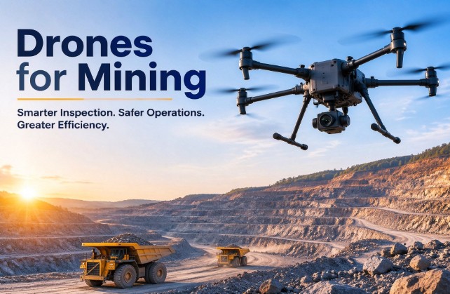
Table of Contents
What Are Drones for Mining?
Mining drones are UAV platforms that have been purposely developed for rugged industrial environments including mining, mineral exploration, geomatics surveying, safety at sites, and environmental surveillance.
Contrary to the consumer drones, the industrial mining drones come with more rugged construction having higher protection levels, high wind resistance, and payload expansion options to operate reliably in very tough mining conditions which include heavy dust, strong magnetic interference, and high altitude.
Core Payload Configurations and Functions
Depending on specific mission requirements, mining drones can be equipped with the following professional sensors:
- High-Resolution RGB Cameras: Capture crisp surface imagery for photogrammetric 3D modeling and visual infrastructure inspection.
- LiDAR Systems (Light Detection and Ranging): Penetrate vegetation or dense dust to capture high-density 3D point cloud data, ideal for high-precision terrain modeling.
- Multispectral Sensors: Capture spectral reflectance across specific bands to analyze vegetation health and evaluate ecological restoration.
- Thermal Infrared Cameras: Detect spontaneous combustion hazards (such as thermal anomalies in coal piles), equipment overheating, and conduct nighttime safety patrols.
Main Mining Drone Types
Selecting the right drone architecture is critical to ensuring project ROI (Return on Investment). The table below outlines the core performance metrics of three common industrial drone types:
| Drone Type | Core Advantages | Selection Recommendations & Typical Applications |
| Multirotor | Vertical takeoff and landing (VTOL), precise hovering, close-range inspection. | Suitable for small-scale detailed inspections, localized highwall photography, and close-up facility checks. |
| Fixed-Wing | High cruise speed, long range, large area coverage. | Ideal for initial macro-terrain surveys of large mines over tens of square kilometers (requires runway space for takeoff/landing). |
| VTOL (Vertical Takeoff and Landing Fixed-Wing) | Combines the vertical takeoff/landing of multirotors with the efficient cruising of fixed-wing aircraft. | Top choice for comprehensive mine surveying: requires no runway, combining large-area long-endurance coverage with flexible deployment in complex terrains. |
7 Key Applications of Drones in Mining
1. Mining Surveying and Topography Mapping
Topography in active mines changes daily. Traditional ground surveying relies on surveyors manually recording points, which is inefficient and leaves blind spots. Equipped with RTK/PPK centimeter-level positioning modules, surveying drones fly autonomously along predefined flight plans to rapidly generate Orthomosaic Maps, Digital Elevation Models (DEM/DSM), and high-density 3D point clouds.
This data can be directly imported into mining software such as Surpac, Datamine, and AutoCAD, helping engineers accurately calculate stripping ratios and guide mining plans.
2. Stockpile Volume Measurement
Inventory auditing of material storage (ore, coal, waste rocks) affects directly the accounting of company assets and production planning. The use of drones for aerial modeling enables workers to perform inventory tasks within hours instead of days using the following workflow:
- Data Acquisition: Flight platform, fitted with the high-resolution camera or LiDAR, flies over the yard where materials are stored.
- 3D Reconstruction: 3D model construction occurs automatically by professional photogrammetric software.
- Base Plane Fitting & Volume Calculation: When you define the base plane of the pile, volume calculation will happen automatically.
The benefit of this is that the number of inventories for ore stockpiles, coal stockpiles, and waste rock piles will increase automatically.
3. Open-Pit Mine Inspection
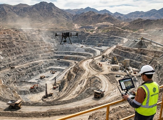
Open pit mines contain large mine sites where there is heavy traffic of people and machines. Drones give a bird’s eye view of the mining benches, haul roads, drainages and excavation site to identify any road collapse, blockage of drainages or any non-compliant mining activity at a faster rate.
4. Highwall and Slope Monitoring
Rock fall and landslides from the highwall are the main threats in open-pit mining operations. Since the slope is too steep to be accessed safely by the staff, a drone can do an oblique photogrammetry modeling from a safe distance. Using comparison of surface data in 3D over a period of time, geotechnical engineers can easily spot crack development and sliding patterns.
5. Mining Infrastructure Inspection
Areas like conveyor belts, high-rise processing plants, high-voltage power lines, and tailing dam operations cover vast expanses and constitute potentially dangerous workplaces. Drones carrying payloads of magnifying zoom and infrared cameras can substitute for humans in high altitude situations and help detect structural defects, overheated engines, and pipeline leaks.
6. Environmental Monitoring & Rehabilitation
Drone monitoring for land disturbances, water pooling, and vegetation recovery rates in waste dumps can take place consistently throughout the development and closure stages of green mines. Coupled with multispectral payload technology, drones are capable of measuring the vigor of crops and vegetation in land reclamation sites.
7. Underground Mine Exploration
Drones that have the ability to conduct autonomous SLAM navigation, use LiDAR technology, and come fitted with high-powered lighting can be used in underground conditions where GPS signals are absent (Non-GPS), lighting is poor, and there is limited space to enter an uncharted area after an explosion for 3D scanning purposes.
Why Mining Enterprises Are Fully Adopting Drone Solutions
The use of drones in mining operations is facilitated by the many safety and economical gains that are provided by this technology to corporations.
Ultimate Safety Protection
Safety remains the most important thing in mine operations. The use of drones ensures that surveying and inspection teams are kept far from hazardous locations such as areas where there is blasting going on, unsteady slopes, cliffs, and areas underground that have poisonous gases.
Cost Reduction, Efficiency Gain, and Zero Operational Interruption
Ground surveying usually involves stopping heavy haul trucks or excavators in order to protect the safety of surveyors, thus resulting in losses of productivity due to production down time. Drones work in the airspace above the ground and do not cause any disruptions in ground machine activities.
High-Density Data & Data-Driven Decision Making
Whereas traditional approaches have been restricted to sparse sampling points, one flight by a drone can produce millions of 3D spatial coordinates. The high-density data can be easily incorporated into the mine GIS systems and other business-to-business mining planning software like Surpac and Datamine, allowing for the formation of more accurate mining and blasting strategies from 3D data.
How to Choose the Right Drone for Mining?
To ensure the successful implementation of a drone project, it is recommended to evaluate the following dimensions when procuring an industrial drone platform:
Endurance & Coverage:
Examine the region where survey is needed with one flight. In case you require survey of huge open pit mines covering thousands of square kilometers, then consider VTOL (Vertical Take Off and Landing Fixed Wing) platforms with endurance over 60 minutes. For one kilometer localized inspection or point survey, then an industrial multicopter will be fine.
Payload Flexibility & Expansion:
The applications in mining are varied and thus the drone must have flexible and expandable payloads. Ensure the flight platform has a universal quick release gimbal mount which can enable it switch from RGB orthophoto camera, oblique photo camera, LiDAR to Thermal Camera depending on the application.
Environmental Adaptability & Wind Resistance:
Mining environments are challenging, often characterized by strong winds, heavy dust, and high elevation changes. Ensure the chosen platform features a high wind resistance rating (preferably Level 6 or above / 12 m/s), a broad operating temperature range, and suitable dust/water protection (IP rating).
Survey-Grade Positioning Accuracy (RTK/PPK):
For surveying and volume calculation tasks, the drone must integrate a centimeter-level RTK/PPK dual-frequency positioning module to minimize reliance on Ground Control Points (GCPs), thereby enhancing field efficiency while maintaining high accuracy.
Why Choose VastArrive Industrial UAV Solutions?
When procuring mining drones, selecting a stable, adaptable, and customizable industrial UAV platform is key to project success.
VastArrive specializes in the R&D and manufacturing of industrial-grade drone solutions. Our product lineup includes long-endurance VTOL fixed-wing drones, versatile multirotors, and heavy-lift industrial UAV platforms designed to meet the rigorous demands of the mining sector:
If you are looking for high-performance, highly reliable mine surveying and inspection drone solutions, feel free to contact the VastArrive expert team for product documentation and customized solution proposals.
Conclusion
Drones in industrial operations have become an essential productivity tool for modern-day mining in the face of the industry’s transition towards digitization and automation. Through scientific choice and use of UAVs that meet the requirements of businesses, mining companies are able to greatly increase their data collection capabilities and minimize risk.
Looking to enhance your mine’s digital surveying and inspection efficiency? Contact VastArrive industrial drone experts today to explore professional UAV platforms and tailored solutions for your mining projects.